Where Is Larak Island?
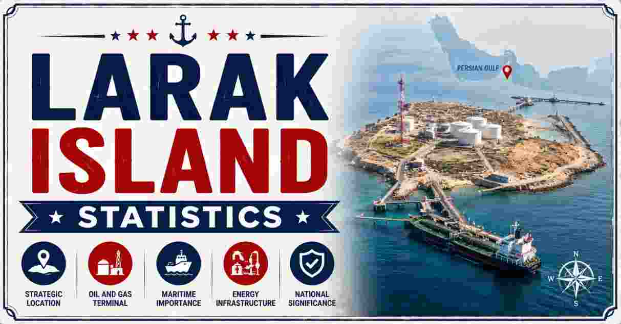
Larak Island is a small island located within the Strait of Hormuz, administered as part of Hormozgan Province under Qeshm County. The island lies southeast of the much larger Qeshm Island and south of Hormuz Island, occupying a position near the narrowest point where the Persian Gulf meets the Gulf of Oman. Geologically, Larak is a salt plug, or salt dome, its surface composed of sandstone, rock salt, and iron oxide, with a series of hills rising to the island’s highest point.
Despite its modest size, Larak sits within one of the most geographically notable stretches of coastline in the region, close to the point where the Strait of Hormuz narrows to its tightest passage. This report breaks down Larak’s area, location, population, and administrative details using the most current publicly available data.
Key Larak Island Facts in 2026
| Fact | Figure |
|---|---|
| Total area | 49 km² (19 sq mi), per Wikipedia/Wikidata; some sources cite up to 77 km² |
| Population (2016 census) | 421 residents, across 115 households |
| Highest elevation | 138 meters (453 feet) above sea level |
| Province | Hormozgan Province |
| County | Qeshm County |
| District | Central District, Larak Rural District |
| Coordinates | Approximately 26°51′N, 56°21′E |
| Distance from Bandar Abbas | Roughly 45 km southeast |
| Distance from Qeshm Island | Around 18 km southeast of Qeshm’s eastern end |
| Narrowest point of the Strait of Hormuz (near Larak) | About 39 km (24 miles) wide |
Source: Wikipedia “Larak Island” and “Larak Rural District” entries; Wikidata Larak Island record.
Taken together, these figures describe a genuinely tiny inhabited landmass. At just 49 square kilometers, Larak is smaller than many mid-sized city districts, with a modest population spread across a single village settlement. Its geography places it near one of the narrower stretches of the Strait of Hormuz, at approximately 39 kilometers wide at its closest point to the opposite shore.
The island’s small population of 421 residents, as recorded in the 2016 census, reflects a community that has remained relatively stable in size over recent decades, concentrated entirely within one settlement rather than spread across multiple villages. Understanding Larak’s basic statistical profile — its area, elevation, and position relative to neighboring islands — offers a clear picture of one of the smaller inhabited islands in this part of the Persian Gulf.
Larak Island Area and Geography Statistics 2026
| Geographic Metric | Figure |
|---|---|
| Total area (Wikipedia/Wikidata figure) | 49 km² (19 sq mi) |
| Total area (alternate source, Persia Planet) | 77 km² |
| Island’s largest diameter | 6.10 km |
| Island length | Roughly 11 km (per SurfIran travel guide) |
| Highest elevation | 138 m (453 ft) |
| Geological classification | Salt plug / salt dome |
| Surface composition | Sandstone, rock salt, and iron oxide |
| Coastal water depth range | 2 to 33 meters, gentle slope |
Source: Wikipedia “Larak Island”; Wikidata Q967421; SurfIran Larak Island Travel Guide; Persia Planet Iran Travel Information.
Larak Island Area: Conflicting Source Figures (Square Kilometers)
Wikipedia/Wikidata figure    ████████████████ 49 km²
Persia Planet figure         █████████████████████████ 77 km²
Larak’s exact land area varies noticeably depending on the source consulted, ranging from the 49-square-kilometer figure most commonly cited by Wikipedia and Wikidata to a larger 77-square-kilometer estimate found in some travel and tourism sources. This kind of discrepancy is common for smaller, less-surveyed islands, and likely reflects differing methodologies — some measurements may include or exclude the island’s surrounding tidal flats and shallow reef areas, which shift with tide and season around a coastline this small.
Geologically, Larak’s identity as a salt plug or salt dome — formed by underground salt deposits pushing upward through overlying rock layers — gives the island its distinctive hilly terrain, cresting at 138 meters above sea level. This same geological process is common throughout the region’s islands, and the resulting sandstone, rock salt, and iron oxide surface composition has historically made these Persian Gulf islands, including neighboring Hormuz Island, visually striking with their reddish, mineral-streaked hillsides.
Larak Island Location Statistics 2026
| Location Metric | Figure |
|---|---|
| Coordinates | 26°51′12″N, 56°21′20″E |
| Body of water | Strait of Hormuz, adjacent to the Persian Gulf |
| Position relative to Qeshm Island | East, ~18 km southeast of Qeshm’s eastern end |
| Position relative to Hormuz Island | South |
| Distance from Bandar Abbas | ~45 km southeast (30 km per some sources) |
| Nearest Omani territory | Great Quoin Island, across the strait’s narrowest point |
| Narrowest strait width (Larak to Oman) | ~39 km (24 miles) |
| Access routes | Zakari Qeshm wharf or motor boats from Doha Qeshm wharf |
Source: Wikipedia “Larak Island”; Wikipedia “Larak Rural District”; Persia Planet Iran Travel Information.
Larak Island's Position Relative to Nearby Landmarks (Approximate Distances)
Bandar Abbas to Larak         ████████████████ ~45 km
Qeshm Island to Larak         ███████ ~18 km
Larak to Oman (narrowest pt.) ██████████████ ~39 km
Larak’s precise location — roughly 18 kilometers southeast of Qeshm Island and 45 kilometers southeast of Bandar Abbas — places it within the cluster of islands near the narrowest section of the Strait of Hormuz. This is the exact stretch of water where the strait pinches down to approximately 39 kilometers between the Iranian and Omani coasts.
Access to Larak is limited to boat travel, typically from wharves on the eastern end of Qeshm Island. The island’s relatively remote position, reachable only by a short sea crossing, has helped keep it a small, quiet settlement compared to the larger, more developed islands and mainland ports in the surrounding area.
Larak Island Population and Demographics Statistics 2026
| Population Metric | Figure |
|---|---|
| 2006 census population | 466 residents, 98 households |
| 2011 census population | 473 residents, 109 households |
| 2016 census population | 421 residents, 115 households |
| Population change, 2006-2016 | -9.7% |
| Household count change, 2006-2016 | +17.3% (98 to 115 households) |
| Largest/only settlement | Larak Shahri, the rural district capital |
| Abandoned villages recorded | Larak Kuhi and Mowrona, listed with no inhabitants |
| Administrative reassignment | Moved from Shahab District to Central District in 2017 |
Source: Wikipedia “Larak Rural District” and “Larak Shahri” entries, citing 2006, 2011, and 2016 Iranian national censuses.
Larak Island Population Trend, 2006-2016 (Census Data)
2006   ████████████████████████ 466
2011   ████████████████████████ 473
2016   █████████████████████ 421
Larak’s population has followed a modest but noticeable decline over the decade separating the 2006 and 2016 censuses, dropping from 466 to 421 residents — a 9.7% decrease that mirrors broader outmigration trends seen across many smaller island and coastal communities in the region, as younger residents relocate toward larger mainland cities for education and employment opportunities. Notably, this population decline occurred even as the number of households increased from 98 to 115, suggesting smaller average family sizes on the island rather than a simple proportional loss of residents.
The presence of two formally recorded but entirely abandoned villages — Larak Kuhi and Mowrona — within the rural district’s official boundaries underscores how concentrated Larak’s remaining population has become in a single settlement, Larak Shahri. With the entire district’s population living in this one village as of the most recent census, Larak represents an extreme case of settlement consolidation even by the standards of the region’s sparsely populated islands.
Larak Island History Statistics 2026
| Historical Metric | Figure |
|---|---|
| Era of Portuguese fortress construction | Safavid era, 16th-17th century |
| Fortress construction materials | Saroj mortar, coral, and sea stones |
| Fortress size ranking among regional Portuguese forts | Largest, after Hormuz Island’s fortress |
| Period of Portuguese control over Gulf islands | 16th century into the 1620s |
| Forces that ended Portuguese control | Safavid dynasty and English naval forces |
| Historical subsistence economy | Fishing, pearl diving, and date cultivation |
| Historical population character | Small community of fishermen and pearl divers |
| Larak becoming a recognized Iranian oil export point | Since 1987 |
Source: SurfIran Larak Island Travel Guide; Persia Planet Iran Travel Information; Arasbaran.org island profile.
Larak Island Historical Timeline
16th-17th c.   Portuguese fortress built during the Safavid era
1620s          Portuguese control ends; Safavid and English forces retake the strait
Pre-20th c.    Small fishing and pearl-diving community
1987           Larak recognized as one of Iran's oil export points
Larak’s most prominent historical landmark, the Portuguese Fortress, was constructed during the Safavid era using a combination of saroj mortar, coral, and sea stones — building materials well suited to the island’s hot, humid coastal environment. Notably, sources describe Larak’s fortress as larger than its counterparts on nearby Qeshm Island, ranking second in scale only to the fortress on Hormuz Island, and its robust wooden support columns have helped the structure remain standing centuries later.
Before any of the infrastructure development associated with the modern era, Larak was, for centuries, a quiet fishing and pearl-diving outpost, its small population sustained by the sea and limited date cultivation on the island’s arid land. This traditional way of life persisted largely unchanged until the late 20th century, a shift that nonetheless left the island’s small resident population and traditional fishing economy largely intact.
Larak Island Climate Statistics 2026
| Climate Metric | Figure |
|---|---|
| Climate classification | Hot desert climate |
| Average summer high temperature | 35°C to 38°C (95°F to 100°F), peaking in June/July |
| Average winter low temperature | Around 15°C (59°F) |
| Temperature range (broader estimate) | 14°C to 37°C (57°F to 99°F) |
| Summer humidity levels | Often above 70% |
| Annual precipitation | Typically under 200 mm, concentrated in winter showers |
| Best months to visit | January and February |
| Hottest, most humid months | July through September |
Source: TravelDojo Larak Island climate profile; Persia Planet Iran Travel Information; Trek.zone Larak Island guide.
Larak Island Seasonal Temperature Range (Approximate, Celsius)
Winter (Jan-Feb, mildest)   ████████████ 15-30°C
Summer (Jun-Sep, hottest)   █████████████████████ 35-38°C+
Larak’s hot desert climate brings genuinely extreme conditions for much of the year, with summer temperatures regularly climbing into the mid-to-high 30s Celsius and humidity levels frequently exceeding 70%, a combination that makes the peak summer months from July through September particularly demanding for anyone spending extended time outdoors. This intense heat and humidity is typical of small islands throughout this stretch of the Persian Gulf, where the surrounding warm sea water amplifies humidity even as land temperatures soar.
The island’s milder winter season, running roughly from November through March, offers a dramatically more comfortable experience, with January and February widely cited as the ideal window when daytime temperatures hover in a far more manageable range. This seasonal pattern, combined with minimal annual rainfall concentrated almost entirely in the winter months, shapes nearly every aspect of life and activity on the island, from fishing schedules to the timing of any visits.
Larak Island Economy and Local Life Statistics 2026
| Economic Metric | Figure |
|---|---|
| Primary economic activities | Fishing and diving |
| Secondary economic activity | Limited agriculture |
| Notable local food product | Tandoori fish, sold fresh by local fishermen |
| Traditional livelihood (historical) | Fishing, pearl diving, and dates |
| Language spoken on the island | Rārakī, a Southwestern Iranian language |
| Rārakī lexical similarity to Persian | ~72% |
| Rārakī Arabic influence | ~12% |
| Common bilingual pattern | Residents typically also speak Persian and regional Arabic varieties |
Source: SurfIran Larak Island Travel Guide; Grokipedia Larak Island entry, citing linguistic community research.
Larak Island Local Economy: Primary Activities
Fishing and Diving        ██████████████ Primary
Limited Agriculture       ████ Secondary
Daily economic life on Larak remains centered almost entirely on the sea, with fishing and diving forming the backbone of the local economy much as they have for generations. Fresh seafood, including the island’s well-known Tandoori fish, is commonly sold directly by local fishermen, giving visitors and neighboring island residents alike a direct connection to the island’s small-scale, largely self-sufficient economic model. Agriculture plays only a limited supporting role, constrained by the island’s arid climate and modest freshwater resources.
Linguistically, Larak is home to speakers of Rārakī, a distinct Southwestern Iranian language that shares roughly 72% lexical similarity with Persian alongside a smaller 12% Arabic influence, reflecting the island’s history of trade and migration across the Persian Gulf. Most residents are multilingual, speaking Rārakī as a first language while also communicating in standard Persian and regional Arabic dialects, a linguistic profile shaped by centuries of maritime contact between Persian, Arab, and other Gulf trading communities.
Larak Island Environment and Marine Life Statistics 2026
| Environmental Metric | Figure |
|---|---|
| Coral reef water depth range | 2 to 33 meters, gentle slope |
| Identified scleractinian coral species | 37 species |
| Notable coral coverage (Acropora species, surveyed areas) | Up to 83% |
| Prominent coral families present | Acroporidae and Faviidae |
| Notable marine species using island beaches | Hawksbill and green sea turtles (nesting) |
| Marine life diversity | Corals, anemones, and ornamental fish |
| Notable nighttime phenomenon | Bioluminescent plankton along the shoreline |
| Landmark structure on the island’s north end | Larak Lighthouse, red and white |
Source: Arasbaran.org island profile; Iran Daily/Newspaper.irandaily.ir; SurfIran Larak Island Travel Guide.
Larak Island Coral Reef Composition (Surveyed Areas)
Acropora species coverage             ████████████ Up to 83%
Other coral families (Faviidae, etc.) ████████ Remainder
The waters surrounding Larak host some of the most diverse coral reef environments in the Persian Gulf, with researchers identifying 37 distinct species of scleractinian, or stony, coral in the surrounding reefs. In surveyed areas, fast-growing Acropora coral species account for as much as 83% of coral coverage, alongside significant presence from the Acroporidae and Faviidae coral families, making Larak’s reef system a genuinely notable marine habitat for the region.
Beyond the corals themselves, Larak’s beaches serve as nesting sites for both hawksbill and green sea turtles, two species whose presence further underscores the ecological value of the island’s relatively undeveloped coastline. Visitors and researchers alike have also documented a striking nighttime phenomenon along Larak’s shores, where bioluminescent plankton interacting with breaking waves creates a glowing visual effect at the water’s edge — a detail that, alongside the island’s red-and-white lighthouse standing at its northern point, adds to Larak’s distinct natural character.
Larak Island Culture and Local Traditions Statistics 2026
| Cultural Metric | Figure |
|---|---|
| Notable cultural site | Traditional cemetery with unique burial customs |
| Cemetery ritual practice | Small brazier burned at each grave |
| Materials burned in the ritual | Wild rue, incense, and frankincense |
| Ritual’s cultural significance | Symbolizes respect for ancestors and connection to nature |
| Accommodation options on the island | Camping site; limited formal lodging |
| Nearby islands offering hotel stays | Qeshm and Kish Islands |
| Recognized tourism potential | Cited as a candidate for sustainable tourism development |
| Typical visit format | Day trip or multi-day stay via camping |
Source: Iran Daily/Newspaper.irandaily.ir Larak Island feature; SurfIran Larak Island Travel Guide.
Larak Island Visitor Experience: Key Draws
Traditional cemetery ritual          ████████████████████ Cultural
Portuguese Fortress                  ████████████████████ Historical
Coral reefs and marine life          ████████████████████ Natural
Bioluminescent plankton, lighthouse  ████████████████████ Scenic
One of Larak’s more distinctive cultural practices centers on its traditional cemetery, where local custom involves burning a small brazier of wild rue, incense, and frankincense at each individual grave. This ritual, blending the island’s native culture with deeper spiritual values, represents a longstanding way islanders express respect for ancestors while maintaining a symbolic connection to nature — a practice that has drawn interest from visitors seeking to understand the island’s living cultural traditions rather than only its physical geography.
Given the island’s limited formal accommodation — largely restricted to a single camping site, with more conventional hotel options available only on the larger neighboring islands of Qeshm and Kish — most visits to Larak take the form of day trips rather than extended stays. This has been described by regional tourism observers as part of the island’s broader, still largely untapped potential as a sustainable tourism destination, where the combination of quiet mountains, clear blue water, glowing plankton, diverse wildlife, and historic buildings like the Portuguese Fortress offers a genuinely distinctive experience for nature lovers and cultural travelers alike. For a look at how a nearby island’s population and cultural profile compares in scale, our Hormuz Island population statistics report covers Larak’s larger northern neighbor in similar depth.
Larak Island Administration and Governance Statistics 2026
| Administrative Metric | Figure |
|---|---|
| Province | Hormozgan |
| County | Qeshm County |
| District | Central District (since 2017); previously Shahab District |
| Rural district | Larak Rural District |
| Capital of the rural district | Larak Shahri |
| Time zone | UTC+3:30 (Iran Standard Time) |
Source: Wikipedia “Larak Rural District” administrative infobox; national census and administrative division records.
Larak Island Administrative Hierarchy
Hormozgan Province
 └── Qeshm County
      └── Central District (since 2017)
           └── Larak Rural District
                └── Larak Shahri (capital, sole settlement)
Larak’s administrative structure reflects a standard multi-tier system of provinces, counties, and districts, with the island forming its own rural district nested within Qeshm County’s Central District. The 2017 reassignment from the former Shahab District to the Central District represents a relatively minor bureaucratic reshuffling, but it’s a useful marker for understanding how administrative boundaries periodically shift around this stretch of coastline as population and governance needs change over time.
With its entire population concentrated in one village capital, Larak’s governance needs remain relatively simple compared to larger, multi-settlement districts. This administrative compactness is itself a reflection of the island’s small size and population, which together shape how local services and infrastructure are organized. For readers interested in the broader administrative and geographic profile of another compact, well-documented location, our Islands Near Dubai statistics report offers a useful comparison point from elsewhere in the Persian Gulf.
Larak Island Compared to Nearby Islands 2026
| Island | Area | Population |
|---|---|---|
| Larak Island | 49 km² | 421 (2016) |
| Hormuz Island | Larger than Larak | Higher population |
| Qeshm Island | Much larger, the region’s largest island | Tens of thousands |
| Kharg Island | Separate Persian Gulf island | Small resident population |
| Great Quoin Island (Oman) | Small | Uninhabited/minimal |
Source: Wikipedia comparative island entries; Persia Planet Iran Travel Information.
Placed alongside its island neighbors, Larak sits toward the smaller end of the inhabited islands scattered through the Strait of Hormuz, dwarfed by Qeshm Island, the region’s largest island and the administrative hub Larak itself falls under. Hormuz Island, Larak’s neighbor to the north, is both larger in area and home to a bigger population, while smaller landmasses like Great Quoin Island off the Omani coast remain largely uninhabited by comparison.
The broader cluster of islands scattered across the Persian Gulf and Strait of Hormuz — from Larak, Hormuz, and Qeshm to Kharg further up the coast — collectively form one of the more geographically distinctive stretches of coastline in the region. For readers wanting the fuller statistical picture of one of these neighboring islands, our dedicated Kharg Island statistics report covers another notable Persian Gulf island in similar detail, offering useful context for understanding how these islands compare in size, population, and geography.
Disclaimer: The data research report we present here is based on information found from various sources. We are not liable for any errors or damages of any kind that may result from the use of the information herein. We acknowledge that though we try to report accurately, we cannot verify the absolute facts of everything that has been represented.