
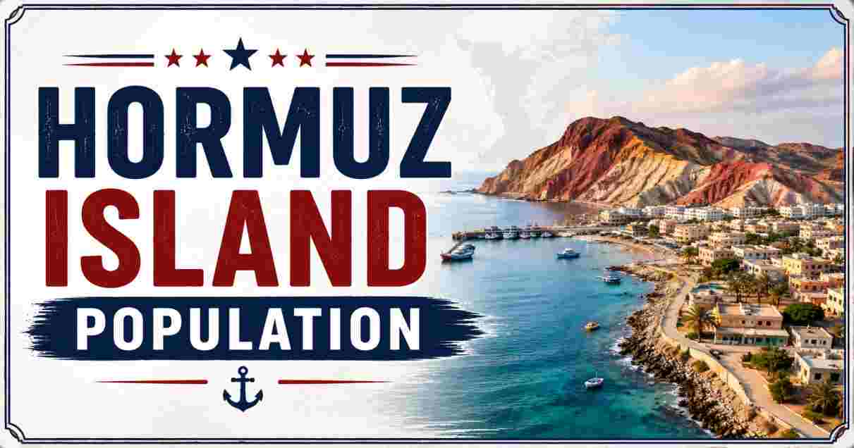
Hormuz Island in 2026
Hormuz Island is a small, mostly barren Iranian island sitting directly in the Strait of Hormuz, the narrow waterway through which roughly 20% of the world’s oil and liquefied natural gas passes. Just 42 square kilometers (16.2 square miles) in size and located only 8 kilometers (5 miles) off Iran’s southern coast near Bandar Abbas, the island is home to a permanent population that official Iranian census figures place at just 5,891 people as of the 2016 count — though broader estimates that include seasonal workers and tourism-linked residents put the figure as high as 6,000 to 10,000. In 2026, that small population finds itself living at the geographic center of one of the year’s most consequential global conflicts.
Hormuz Island has become known internationally in recent years less for its strategic location than for its extraordinary geology — a landscape locals and visitors alike call the “Rainbow Island” for its more than 70 distinct shades of mineral-rich soil, ranging from deep red ochre to yellow, purple, and white. But 2026 has placed a very different spotlight on the island: the ongoing US-Israel war with Iran and the resulting Strait of Hormuz crisis, which began on February 28, 2026, has disrupted shipping, tourism, and daily life for the island’s small, resilient community. This article compiles the most current, verified statistics on Hormuz Island’s population, area, geography, and its position within the 2026 regional crisis.
Interesting Facts About Hormuz Island in 2026
| Fact | Detail |
|---|---|
| Total Land Area | 42 km² (16.2 sq mi) |
| Distance from Iranian Mainland | 8 km (5 miles), near Bandar Abbas |
| 2016 Census Population | 5,891 |
| Broader Population Estimate (incl. seasonal) | 6,000–10,000 |
| Province | Hormozgan |
| County | Bandar Abbas County |
| Elevation (Highest Point) | 186–187 meters (610–614 ft) |
| Only Permanent Settlement | Hormuz village/city |
| Distinctive Feature | 70+ shades of colorful mineral soil (“Rainbow Island”) |
| Strait of Hormuz Global Oil Share | ~20–25% of world’s seaborne oil trade |
Source: Wikipedia (Hormuz Island); Britannica; Iran Statistical Centre (2016 National Census); Wikidata
The gap between the official 5,891 census figure and the broader 6,000-to-10,000 estimate cited in tourism and development reporting reflects a genuinely fluctuating population rather than conflicting data — Britannica notes explicitly that “the population may decline by half in summer through migration,” as families historically moved to cooler quarters in the past and, more recently, as workers travel to and from Bandar Abbas for employment. This pattern of seasonal population swing is common across small Persian Gulf island communities, where the extreme summer heat and the practicalities of island-based work create a genuinely mobile, rather than fixed, resident population.
What makes Hormuz Island’s 42-square-kilometer footprint so disproportionately significant is not its size but its position: sitting directly within the Strait of Hormuz, the island lies at the heart of a passage responsible for roughly a fifth to a quarter of all seaborne oil traded globally. That strategic weight, largely a background fact during peacetime, has become the island’s defining characteristic throughout 2026, as the broader regional conflict has turned a quiet fishing and tourism community into a place whose daily life is directly shaped by international military and economic developments far beyond its own small population’s control.
Hormuz Island Location and Geography Statistics 2026
| Metric | Data |
|---|---|
| Coordinates | 27°04′03″N 56°27′36″E |
| Located Within | Strait of Hormuz, Persian Gulf |
| Length | ~7 km |
| Width | ~7.6 km |
| Nearest Major City | Bandar Abbas (via ferry) |
| Ferry Crossing Time | 40–50 minutes |
| Ferry Ticket Cost | $2–3 |
| Neighboring Larger Island | Qeshm Island (1,491 km², population 148,993) |
Source: Wikipedia (Hormuz Island); Wikidata; Adventures of Nicole travel guide, March 2026
Hormuz Island’s position 8 kilometers off the Iranian coast, reached by a 40-to-50-minute ferry crossing from Bandar Abbas, places it close enough to the mainland for practical daily and seasonal travel, yet far enough to have preserved a genuinely distinct, isolated community identity over centuries. That accessibility — a short, inexpensive ferry ride costing just $2 to $3 — has been central to the island’s modest but growing tourism economy in recent years, even as 2026’s regional conflict has disrupted much of that travel pattern.
Compared with its much larger neighbor Qeshm Island, which spans 1,491 square kilometers and hosts nearly 149,000 residents, Hormuz’s 42-square-kilometer footprint and roughly 6,000-person population make it a genuinely small settlement by regional standards — yet its geographic position within the strait gives it a strategic profile entirely disproportionate to its physical or demographic scale, a dynamic that has become especially apparent throughout 2026.
Hormuz Island Population and Demographics Statistics
| Census Year | Population | Households |
|---|---|---|
| 2006 | 5,699 | 1,143 |
| 2011 | 5,867 | 1,345 |
| 2016 | 5,891 | 1,698 |
| Population Growth, 2006–2016 | +3.4% | — |
| Household Growth, 2006–2016 | +48.6% | — |
| Predominant Ethnic Group | Bandari people | |
| Predominant Religion | Sunni Muslim (distinct from Iran’s Shia majority) |
Source: Wikipedia (Hormuz District); Iran Statistical Centre 2016 National Census; Wikidata
Hormuz Island’s population has grown only modestly across the three most recent Iranian census counts — from 5,699 in 2006 to 5,891 in 2016, a 3.4% increase over a decade. Far more striking is the 48.6% jump in household count over the same period, from 1,143 to 1,698 households, indicating a significant shift toward smaller average household sizes even as the total population barely moved — a demographic pattern consistent with broader trends across Iran’s coastal and island communities.
The island’s Bandari people, whose distinctive dialect reflects centuries of trade contact with Portuguese, Dutch, English, Hindi, and Arabic-speaking merchants, hold a religious identity that sets Hormuz apart within Iran more broadly: the community is predominantly Sunni Muslim, a minority faith within a nation whose population is overwhelmingly Shia. This distinct cultural and religious inheritance, shaped by the island’s long history as a Persian Gulf trading crossroads rather than an inland Persian settlement, remains a defining feature of local identity today.
Hormuz Island Geology and Rainbow Valley Statistics 2026
| Metric | Data |
|---|---|
| Distinct Soil Colors Documented | 70+ |
| Local Name for Red Ochre | “Golak” |
| Ochre Uses | Artistic pigment, culinary coloring, export |
| Formation Process | Salt dome uplift and volcanic activity, millions of years old |
| Key Landmarks | Rainbow Valley, Red Beach, Silver Beach |
| Conservation Body | Iran’s Department of Environment |
| Reason for Conservation Action | Erosion from tourist overuse of ochre deposits |
Source: Wikipedia (Hormuz Island); Immersive Iran travel guide, January 2026; TripAdvisor, August 2026
The geological phenomenon underlying Hormuz Island’s “Rainbow Island” reputation stems from ancient salt dome formations pushed upward through the earth’s crust over millions of years, combined with volcanic mineral deposits that produced the island’s striking palette of red, yellow, purple, and white soils. The reddish ochre, known locally as Golak, has been used for generations both as an artistic pigment and, notably, as a culinary coloring and flavoring agent — a use case that distinguishes Hormuz’s ochre from purely decorative mineral deposits found elsewhere in the world.
That same popularity has created a genuine conservation challenge: Iran’s Department of Environment has had to take direct action to protect the island’s most photographed ochre deposits from degradation caused by tourist overuse, as visitors collecting soil samples and walking repeatedly across the same fragile formations gradually eroded some of the island’s most distinctive landscape features. This tension between the island’s growing appeal as a natural tourist destination and the fragility of the very geology that makes it appealing has become an increasingly important management issue for local authorities even before 2026’s broader regional disruptions began.
Hormuz Island Historical Timeline Statistics
| Period | Development |
|---|---|
| ~1200s | Hormuz becomes chief market of Kerman; monopolizes India-China trade |
| 13th–14th century | Marco Polo visits the island twice |
| 1514 | Portuguese forces capture Hormuz, build a fort |
| 1514–1622 | 108 years of Portuguese colonial control |
| 1622 | Joint Anglo-Persian forces recapture the island, ending Portuguese rule |
| 2026 | Island sits at center of Strait of Hormuz crisis amid Iran war |
Source: Britannica; Wikipedia (Hormuz Island)
Hormuz Island’s history as a global trade crossroads predates its modern strategic significance by nearly a millennium — by roughly 1200 CE, the island had already become the chief market of Kerman province, monopolizing trade routes connecting India and China to the broader Persian and European trading world, a commercial dominance significant enough to draw two separate visits from the famed Venetian traveler Marco Polo. That centuries-old role as a maritime chokepoint for global commerce is, in a striking historical parallel, essentially the same function the surrounding Strait of Hormuz continues to serve today, just with oil tankers rather than spice caravans.
The island’s 108-year period under Portuguese colonial control, beginning with the 1514 conquest and ending with the joint Anglo-Persian recapture in 1622, left a lasting linguistic and cultural imprint still detectable in the Bandari dialect spoken on the island today. That the strait separating Hormuz from the Iranian mainland eventually took its name directly from this small island — rather than from any of the region’s larger ports or cities — reflects just how central Hormuz was to European and Persian geopolitical understanding of the region for centuries before oil ever became the resource at stake.
Hormuz Island and the 2026 Strait of Hormuz Crisis Statistics
| Metric | Data |
|---|---|
| Crisis Start Date | February 28, 2026 |
| Underlying Cause | 2026 Iran war (US-Israel military campaign) |
| Merchant Ships Damaged (Regional) | 17+, 7 abandoned |
| Merchant Ships Captured | 2 |
| Seafarers Killed or Missing (Regional) | 12 |
| Strait Oil Trade Share Pre-Crisis | ~25% of world’s seaborne oil |
| Strait LNG Trade Share Pre-Crisis | ~20% of world’s LNG |
| US Naval Blockade Status (Early August 2026) | Reimposed, following brief lifting via June MOU |
Source: Wikipedia (2026 Strait of Hormuz crisis); Congress.gov CRS Report R45281, August 2026
The 2026 Strait of Hormuz crisis, which began the same day as the broader US-Israel military campaign against Iran, has directly threatened the waterway responsible for roughly a quarter of the world’s oil trade — a disruption that, according to Congressional Research Service tracking, has already resulted in more than 17 damaged merchant ships, two captured vessels, and 12 seafarers killed or missing across the strait as of the most recent reporting. Hormuz Island, sitting directly within this contested waterway, has experienced the crisis not as a distant geopolitical event but as an immediate, daily disruption to shipping, security conditions, and the ferry connections the island’s economy depends on.
A brief window of relief came in June 2026, when Presidents Trump and Pezeshkian signed a memorandum of understanding declaring the removal of the US naval blockade and Iranian guarantees of safe passage for 60 days — but by early August 2026, the United States had reimposed its blockade following renewed attacks on commercial vessels, meaning Hormuz Island’s residents have now experienced the crisis’s disruption for roughly six months with only a brief mid-year reprieve. For a closer look at how a neighboring Iranian island in this same strait has similarly been shaped by both its strategic position and the ongoing conflict, the Kharg Island Statistics report documents a comparable case just up the Persian Gulf coast.
Hormuz Island Tourism and Economic Statistics 2026
| Metric | Data |
|---|---|
| Tourism Sector Status (2026) | Sharp decline amid regional conflict |
| Majara Residence Eco-Resort Construction Cost | $900,000 |
| Majara Residence Completion Year | 2020 |
| Majara Residence Award | Aga Khan Award for Architecture, 2025 |
| Construction Technique Used | Superadobe (Nader Khalili method) |
| ATMs/Banks/Card Payment Infrastructure (Jan 2026) | None |
| Best Visiting Season | October–April |
Source: FTNNews, May 2026; theworlddata.com Hormuz Island Statistics 2026; France 24
The island’s tourism sector, which had been steadily growing through eco-tourism, cultural visits, and short-stay holidays in the years before 2026, experienced a sharp downturn as the Strait of Hormuz crisis unfolded, with guesthouses, cafés, and tour operators all reporting reduced visitor numbers as security concerns and disrupted ferry operations discouraged travel to the region. France 24 reported that island residents have remained “anchored” to Hormuz despite the mounting uncertainty, even as the broader regional instability spread from energy and freight markets into the very local tourism economy many island families depend on.
Amid this disruption, the island’s most internationally celebrated development success — the Majara Residence, an eco-tourism project built for just $900,000 using the earthen Superadobe construction technique and awarded the prestigious 2025 Aga Khan Award for Architecture — stands as a symbol of what the island’s tourism sector had been building toward before 2026’s crisis intervened. The complete absence of ATMs, banks, or card payment infrastructure as of January 2026 also underscores just how undeveloped the island’s formal financial infrastructure remains even as it draws international architectural acclaim, a detail that speaks to the genuinely small, cash-based, and locally rooted nature of daily life on Hormuz even at the height of its tourism appeal. For broader context on how other small Gulf islands near major shipping and trade routes have developed their own tourism economies, the Islands Near Dubai Statistics report offers a useful regional comparison point just across the Gulf.
Hormuz Island in Regional Population Context 2026
| Location | Population | Area |
|---|---|---|
| Hormuz Island | ~5,891–10,000 | 42 km² |
| Qeshm Island | 148,993 | 1,491 km² |
| Hormozgan Province (Total, 2016) | 177,641 | 70,697 km² |
Source: Wikipedia (Hormozgan province, Qeshm Island)
Set within its own province, Hormuz Island’s population represents just a small fraction of Hormozgan’s roughly 177,641 residents recorded in the 2016 provincial census, underscoring how thinly populated this stretch of Iran’s southern coastline remains even including its provincial capital and larger settlements. For readers interested in how another compact, internationally significant location is measured and reported using a comparable location-statistics format, the Pristina Location Statistics report offers a useful structural comparison, covering the coordinates, area, and administrative geography of a similarly small but strategically notable place.
Understanding Hormuz Island’s population within this broader regional and comparative context helps clarify what makes 2026 such an unusual year for the island: a community of well under 10,000 people, historically defined by fishing, trade, and — more recently — geological tourism, now finds its daily life directly shaped by a military and economic crisis playing out on a genuinely global scale, disproportionate to almost any other measure of the island’s size.
Disclaimer: The data research report we present here is based on information found from various sources. We are not liable for any financial loss, errors, or damages of any kind that may result from the use of the information herein. We acknowledge that though we try to report accurately, we cannot verify the absolute facts of everything that has been represented.