
Where is Pristina Located?
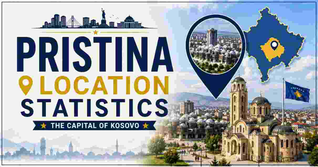
Pristina, officially spelled Prishtinë in Albanian, sits in the northeastern part of Kosovo, positioned at latitude 42.667542° N and longitude 21.166191° E on an alluvial plain in the central-eastern region of the country. As the capital and largest city of Kosovo, Pristina anchors the District of Pristina, the most populous of Kosovo’s six districts, and serves as the nation’s political, educational, and economic center. The city sits at an elevation of 652 meters above sea level, nestled in a basin partially shielded by surrounding hills, giving it a continental climate with distinct seasons that differ meaningfully from Kosovo’s more Mediterranean-influenced southern regions.
Geographically, Pristina occupies a strategic position roughly 520 kilometers south of Belgrade, Serbia, and 90 kilometers north of Skopje, North Macedonia, placing it at a genuine crossroads of the central Balkan Peninsula. This report compiles the key verified statistics on Pristina’s location, covering its precise coordinates, municipal and district area figures, regional geography, borders, and how it fits within Kosovo’s broader physical landscape. Sources include the Kosovo Agency of Statistics (ASK), Wikipedia’s geographic entries for Kosovo and Pristina, LatLong.net coordinate data, and the Nations Online Project’s political mapping of the region.
Interesting Facts About Pristina’s Location
| Fact Category | Key Data Point |
|---|---|
| Latitude and Longitude | 42.667542° N, 21.166191° E |
| DMS Coordinates | 42° 40′ 3.15″ N, 21° 9′ 58.29″ E |
| Elevation above sea level | 652 meters |
| Municipal area (Pristina municipality, 2024) | 572 km² |
| District of Pristina total area | 2,439 km² — largest district in Kosovo |
| Distance south of Belgrade, Serbia | 520 km |
| Distance north of Skopje, North Macedonia | 90 km |
| Time zone | UTC+1 (CET), shifting to UTC+2 (CEST) in summer |
| Country | Kosovo (Republic of Kosovo) |
| Region | Balkan Peninsula, Southeastern Europe |
| Population density (Pristina municipality, 2024) | 397.7 people per km² |
| Position within Kosovo | Northeastern-central Kosovo, on a flat plain |
Source: LatLong.net Pristina coordinates; Wikipedia “District of Pristina” (2024 ASK census data); StudyGuides.com Pristina Overview; MapsOfWorld.com Pristina Map facts
The numbers above confirm Pristina’s position as a genuinely central Balkan city, sitting almost exactly between two of the region’s other major capitals — closer to Skopje than to Belgrade, but positioned along historic trade and transit corridors connecting both. The city’s 652-meter elevation places it comfortably within Kosovo’s characteristic highland-plain terrain, high enough to experience real seasonal temperature swings but low enough to remain agriculturally productive and easily accessible compared to Kosovo’s more mountainous border regions.
What stands out most is the discrepancy between municipal and district area figures: while the city of Pristina itself, as a municipality, covers 572 square kilometers according to Kosovo’s 2024 census data, the broader District of Pristina — which includes eight municipalities and 298 additional settlements — spans a much larger 2,439 square kilometers, making it Kosovo’s largest administrative district by both area and population. This distinction matters for anyone researching Pristina’s statistics, since “Pristina” can refer to the compact urban municipality, the much larger surrounding district, or informally, the built-up city core itself, each with meaningfully different area and population figures.
Pristina’s Exact Coordinates and Map Position
PRISTINA COORDINATE REFERENCE
════════════════════════════════════════════════════════════════════
Decimal Degrees:    42.667542° N,  21.166191° E
DMS Format:         42°40'3.15" N, 21°9'58.29" E
Simplified DMS:     42°40′N,       21°10′E
Elevation:          652 meters above sea level
════════════════════════════════════════════════════════════════════
Nearby reference: 520 km S of Belgrade | 90 km N of Skopje
| Coordinate Metric | Data Point |
|---|---|
| Latitude (decimal) | 42.667542° |
| Longitude (decimal) | 21.166191° |
| Latitude (DMS) | 42° 40′ 3.15″ N |
| Longitude (DMS) | 21° 9′ 58.29″ E |
| Simplified coordinates (commonly cited) | 42°40′N 21°10′E |
| ISO country code | KOS / XK |
| Hemisphere position | Northern and Eastern hemispheres |
| Nearest major geographic reference | Goljak mountains to the northeast |
Source: LatLong.net “Where is Pristina, Kosovo on Map Lat Long Coordinates”; Wikipedia geographic infobox data for Pristina
Pristina’s coordinates place it within the 42nd parallel north, a latitude band it shares with cities including Rome, Barcelona, and Boston, though Pristina’s inland, elevated, continental position gives it a considerably different climate profile than these coastal Mediterranean or Atlantic-influenced comparators. The precision of the decimal coordinate system — accurate to six decimal places — reflects modern GPS-based surveying, a significant improvement over the simplified 42°40′N 21°10′E format still commonly cited in general reference materials and older maps.
The city’s position just north of the mountains of Goljak and south of the broader Kosovo highland systems places it in a natural basin that has made the site attractive for settlement since antiquity, a geographic advantage that predates its administrative status as national capital by well over two thousand years. This basin location, protected on multiple sides by elevated terrain, is a key reason Pristina developed as a regional hub rather than remaining a minor settlement relative to historically larger Kosovo cities like Prizren, Kosovo’s former historic capital.
Pristina Municipal and District Area Statistics
PRISTINA AREA COMPARISON — MUNICIPALITY VS. DISTRICT
════════════════════════════════════════════════════════════════════
Pristina Municipality    ██░░░░░░░░░░░░░░░░░░░░░░░░░░░░░░░░░░  572 km²
District of Pristina     ████████████████████████████████████  2,439 km²
════════════════════════════════════════════════════════════════════
District municipalities: 8  |  District settlements: 298 total
| Administrative Level | Area | Population (2024) | Density |
|---|---|---|---|
| Pristina Municipality | 572 km² | 227,466 | 397.7 per km² |
| District of Pristina (total) | 2,439 km² | 511,307 | 209.6 per km² |
| Podujevë municipality | 632 km² | 70,975 | 112.3 per km² |
| Drenas municipality | 290 km² | 48,079 | 165.8 per km² |
| Lipjan municipality | 422 km² | 55,044 | 130.4 per km² |
| Fushë Kosova municipality | 83 km² | 63,949 | 770.5 per km² — highest density in district |
| Obiliq municipality | 105 km² | 22,815 | 217.3 per km² |
| Gračanica municipality | 131 km² | 18,486 | 141.1 per km² |
| Artana municipality | 204 km² | 4,493 | 22.0 per km² — lowest density |
Source: Wikipedia “District of Pristina,” citing the 2024 national census by the Kosovo Agency of Statistics (ASK)
The District of Pristina’s eight constituent municipalities reveal substantial internal variation in both size and population density, ranging from Fushë Kosova’s compact 83 km² footprint carrying an extremely high density of 770.5 people per km², to Artana’s much larger but sparsely populated 204 km² territory at just 22.0 people per km². This variation reflects the classic pattern of Balkan regional geography: a dense, urbanized core municipality surrounded by a mix of smaller satellite towns and larger, more rural or mountainous outlying municipalities.
Pristina municipality itself, at 572 km² and 227,466 residents, accounts for roughly 44% of the entire district’s population while covering less than a quarter of its total land area, confirming the capital’s role as the overwhelming population and economic center of its surrounding region. The 2024 national census, conducted by the Kosovo Agency of Statistics, represents the most current and authoritative source for these figures, having recently updated population counts across all of Kosovo’s administrative divisions.
Kosovo’s Geographic Region and Borders
KOSOVO'S BORDERS — LENGTH BY NEIGHBORING COUNTRY
════════════════════════════════════════════════════════════════════
Serbia (north/east)       ████████████████████████████████████  380.068 km
North Macedonia (SE)      ██████████████████░░░░░░░░░░░░░░░░░░  170.772 km
Albania (SW)               ████████████░░░░░░░░░░░░░░░░░░░░░░░░  113.551 km
Montenegro (W)              ████████░░░░░░░░░░░░░░░░░░░░░░░░░░░░  79.165 km
════════════════════════════════════════════════════════════════════
Total Kosovo border length: ~700.7–743.6 km (sources vary slightly)
| Geographic Metric | Data Point |
|---|---|
| Kosovo’s total land area | 10,887 km² (99% land, 1% water) |
| Region | Balkan Peninsula, Southeastern Europe |
| Landlocked status | Yes — no coastline, no maritime borders |
| Bordering countries | Serbia, North Macedonia, Albania, Montenegro |
| Border with Serbia (north and east) | 380.068 km — longest border |
| Border with North Macedonia (southeast) | 170.772 km |
| Border with Albania (southwest) | 113.551 km |
| Border with Montenegro (west) | 79.165 km — shortest border |
| Highest point in Kosovo | Gjeravica, 2,656 m (also cited as Velika Rudoka, 2,660 m) |
| Lowest point in Kosovo | White Drin river, 297 m |
| Longest river | White Drin — 122 km |
| Comparable country size | Slightly larger than Cyprus; larger than the US state of Delaware |
Source: Wikipedia “Geography of Kosovo”; Nations Online Project “Political Map of Kosovo”; Kosovo Alpine Club (KAP) Geography page
Pristina’s location within Kosovo places it in a country that is entirely landlocked, situated at the geographic heart of the Balkan Peninsula and bordered by four distinct neighbors, each representing a different cultural and political sphere: Serbia to the north and east (Kosovo’s longest and most politically significant border, given the two countries’ contested history), North Macedonia to the southeast, Albania to the southwest (sharing deep ethnic and linguistic ties with Kosovo’s Albanian-majority population), and Montenegro to the west. Despite having no coastline of its own, Kosovo’s mountainous terrain feeds rivers that ultimately drain into three separate seas — the Adriatic, the Aegean, and the Black Sea — a geographic curiosity that reflects the country’s position on a continental watershed divide.
Kosovo’s total land area of 10,887 square kilometers makes it comparable in size to Cyprus or slightly larger than the US state of Delaware, a genuinely small footprint that nonetheless contains dramatic elevation variation, from the low point along the White Drin river at 297 meters to peaks exceeding 2,600 meters in the mountain ranges along its borders. For readers interested in how Kosovo’s overall standard of living and social wellbeing compares internationally despite its small size, our Countries with Highest Quality of Life Statistics report documents that Kosovo ranked a notable 16th globally on the 2026 World Happiness Report, an unexpectedly strong showing for a country of its size and economic profile.
Pristina’s Position Relative to Other Balkan Capitals
| Reference City | Distance from Pristina | Direction |
|---|---|---|
| Belgrade, Serbia | 520 km | South |
| Skopje, North Macedonia | 90 km | North |
| Tirana, Albania | Approximately 200 km | Southwest (via mountain routes) |
| Podgorica, Montenegro | Approximately 180 km | West |
| Sofia, Bulgaria | Approximately 330 km | East |
Source: LatLong.net Pristina coordinate reference; MapsOfWorld.com Pristina geographic overview
Pristina’s location gives it notably closer proximity to Skopje than to any other regional capital, a mere 90 kilometers away, a distance that makes cross-border travel and trade between Kosovo and North Macedonia considerably more practical than routes toward Belgrade, Tirana, or Podgorica. This proximity has historically shaped trade routes through the region, with the corridor connecting Pristina and Skopje representing one of the more heavily used transit paths in the central Balkans, particularly given the mountainous terrain that complicates more direct routes toward Albania’s coast or Montenegro’s Adriatic ports.
The considerably greater 520-kilometer distance to Belgrade — despite Serbia sharing Kosovo’s longest border — reflects both the mountainous terrain separating the two capitals and the political reality that direct high-speed transit infrastructure between them has historically been limited, a legacy of the unresolved political status between Kosovo and Serbia following Kosovo’s 2008 declaration of independence. This geographic and political context is essential background for understanding regional population movements and demographic shifts across the wider Balkans, a dynamic our Germany Population Statistics report touches on indirectly, given Germany’s status as a major destination for Balkan labor migration and its large resident communities with origins across former Yugoslav states.
Pristina’s Climate and Physical Geography
| Climate/Geography Metric | Data Point |
|---|---|
| Climate classification | Continental (moderate, with Mediterranean and Alpine influences) |
| Average annual temperature | 10.6°C (51°F) |
| Warmest month (average) | August — ~21.8°C (71°F) |
| Coldest month (average) | January — ~-0.6°C (31°F) |
| Terrain type | Flat plain, surrounded by protective hills |
| Nearby lakes | Badovc Lake, Batllava Lake |
| Nearby rivers | Llapi River, Prishtevka River |
| Notable green space | Germia Park, large protected area east of the city |
| Water source for the city | Batllava Lake and Badovc Lake |
| Sunshine hours (Kosovo average) | 2,066 hours per year (~5.7 hours/day) |
Source: Kids.Kiddle.co “Pristina facts for kids”; Klubi Alpin Prishtina Geography page
Pristina’s continental climate, moderated somewhat by Mediterranean and Alpine influences filtering into the Balkan interior, produces a genuine four-season pattern with a roughly 22-degree Celsius swing between the warmest and coldest average monthly temperatures. The city’s location on a flat alluvial plain, protected by surrounding hills, has historically shielded it from the most extreme weather patterns experienced in Kosovo’s higher mountain regions, making it a comparatively hospitable site for the substantial urban population it now hosts.
The city’s reliance on Batllava and Badovc Lakes for its water supply has periodically created water shortage challenges during drier years with reduced rainfall or snowmelt, an infrastructure vulnerability that Kosovo authorities have worked to address given the growing population concentrated in and around the capital. Germia Park, a substantial protected green area to the city’s east, provides Pristina with a significant natural recreation space uncommon in many rapidly urbanizing Balkan capitals, and has become a notable feature of the city’s geography and quality of daily life for residents.
Data Reliability Notes for Pristina Location Statistics
| Category | Status |
|---|---|
| Coordinate data | Consistent across sources; precision varies by decimal places cited |
| Municipal area figures | Some older sources cite 854 km² or 523.13 km², likely reflecting different administrative boundary definitions or outdated data; this report prioritizes the 2024 census figure of 572 km² |
| Kosovo’s total border length | Ranges from 700.7 km to 743.6 km depending on source and measurement methodology |
| Highest point in Kosovo | Cited as either Gjeravica (2,656 m) or Velika Rudoka (2,660 m) depending on source |
Source: Cross-referenced Kosovo Agency of Statistics, Wikipedia, LatLong.net, and Nations Online Project data
Because Pristina’s area has been measured differently across various historical and contemporary sources — with figures ranging from 523.13 km² to 854 km² depending on which administrative boundary definition is used — this report prioritizes the 2024 Kosovo Agency of Statistics census figure of 572 km² for the municipality, as it represents the most current, officially sourced data available. Similarly, minor discrepancies in Kosovo’s total border length and highest-elevation point reflect genuine variation in measurement methodology and rounding across different cartographic and statistical sources rather than any single authoritative figure being incorrect.
Disclaimer: The data research report we present here is based on information found from various sources. We are not liable for any financial loss, errors, or damages of any kind that may result from the use of the information herein. We acknowledge that though we try to report accurately, we cannot verify the absolute facts of everything that has been represented.