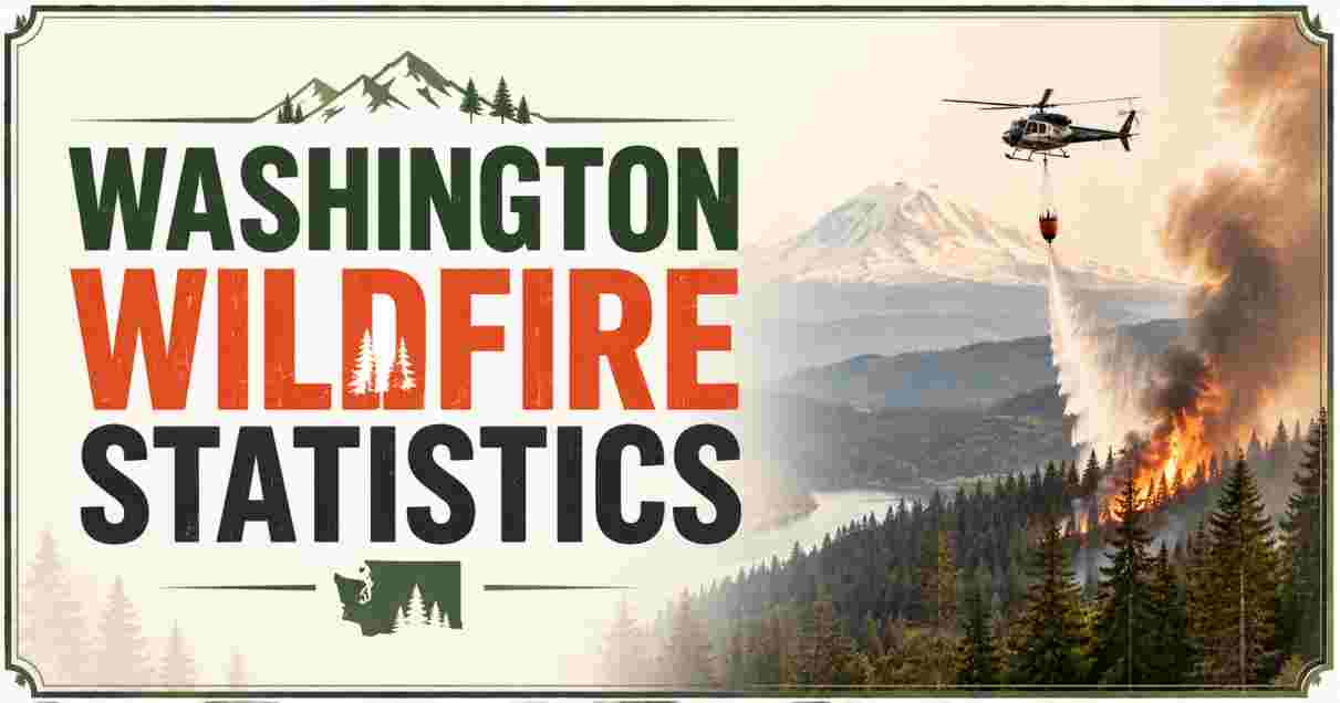
Washington Wildfire in 2026
Washington state is in the middle of what officials are calling one of the most destructive wildfire disasters in its history, as a cluster of fast-moving blazes near Spokane, the state’s second-largest city, destroyed hundreds of homes and forced tens of thousands of residents to flee over the first weekend of August 2026. The Spokane Complex Fire — made up of the Old Trails, Fairview, and Autumn Lane fires — ignited on Saturday, August 1, and by Sunday evening had burned more than 7,700 acres with 0% containment, according to the federal incident management team coordinating the response. Spokane Mayor Lisa Brown described the disaster as “the worst natural disaster our region has faced,” while Washington’s adjutant general said fire conditions were “the worst I have ever seen.”
This report compiles the newest verified statistics on the 2026 Washington wildfire crisis, sourced from the Washington State Emergency Operations Center, the Washington Department of Natural Resources, federal incident management teams, and contemporaneous reporting from the Associated Press, NBC News, ABC News, CNN, and the Spokesman-Review. Because this is an active, rapidly evolving disaster, every figure below is timestamped to the moment it was reported, and readers should expect official damage, evacuation, and casualty figures to be updated as assessment work continues in the days ahead. This report covers the scale of the Spokane Complex Fire, evacuation and shelter numbers, structural damage, statewide fire activity, the governor’s emergency declaration, and how 2026 compares with Washington’s most destructive prior wildfire seasons.
Interesting Facts: Washington Wildfire Statistics 2026
| Interesting Fact | Verified Statistic (as reported) |
|---|---|
| Spokane Complex Fire acreage (as of Sunday evening, Aug 2) | Over 7,700 acres — 0% contained |
| Structures destroyed in the Spokane Complex Fire | At least 600–700 structures (estimates as of Aug 2–3) |
| Old Trails Fire alone — structures destroyed | 640 structures, per Spokane County Fire District 3 |
| People evacuated in the Spokane area | 60,000–65,000+ people |
| Statewide acreage burned (as of Aug 2) | About 250,000 acres (~390 square miles) |
| Number of active wildfires statewide | 15–18 fires burning simultaneously |
| Confirmed deaths or serious injuries (as of early Aug 3) | None confirmed — officials say assessment is ongoing and could change |
| Customers without power (peak, Aug 2) | Over 40,000, later dropping to ~10,000 |
| State of emergency declared | August 1, 2026, by Gov. Bob Ferguson |
| Statewide burn ban | In effect through end of September 2026 |
| First-ever CAL FIRE deployment to Washington | Confirmed by California Department of Forestry and Fire Protection |
| Comparable prior disaster — 2023 Oregon/Gray Fires structures lost | 710 structures — previously the state’s costliest wildfire incident |
| Time since fires ignited to 600+ structures lost | Under 24 hours |
| Fire behavior noted by firefighters | “Crowning” — burning in treetops, unusually fast-spreading |
Source: NBC News, ABC News, CNN, Associated Press, Washington State Standard, Spokesman-Review, KXLY, KHQ, reporting August 1–3, 2026.
The scale and speed of the Spokane Complex Fire is what makes it historically significant, even before final damage totals are confirmed. In under 24 hours after three separate fires ignited Saturday afternoon amid dangerous, dry, windy conditions, at least 600 to 700 structures were destroyed or damaged and 60,000 to 65,000 people were placed under evacuation orders — a toll that, if confirmed, would rival or exceed the state’s previous costliest wildfire disaster, the combined Gray Fire and Oregon Fire of August 2023, which together destroyed 710 structures and killed two people over a period of several weeks. Wildfire Today, an industry trade publication, noted that the number of destroyed structures in Spokane already “rivals the state’s costliest wildfire incident in 2023.”
Critically, as of the most recent reporting early Monday, August 3, officials including Spokane County Sheriff John Nowels have stated there are no confirmed deaths or serious injuries, though multiple local officials — including Spokane County Fire District 3 Chief Cody Rohrbach — have cautioned that “based on radio traffic, it will be anticipated” that fatalities may ultimately be confirmed once search-and-assessment teams can safely access the hardest-hit neighborhoods. This report reflects that genuine uncertainty rather than presenting a single final casualty count, since the situation was actively unfolding at the time of writing and figures are subject to change as Washington’s emergency response continues.
The Spokane Complex Fire: Scale and Timeline
SPOKANE COMPLEX FIRE — TIMELINE, AUGUST 1-3, 2026
════════════════════════════════════════════════════════════
  Sat, Aug 1 (afternoon)   All three fires ignite near Spokane
  Sat, Aug 1 (evening)     Rapid spread; evacuations begin
  Sun, Aug 2 (morning)     Named "Spokane Complex"; 640 structures
                           lost in Old Trails Fire alone
  Sun, Aug 2 (evening)     7,700+ acres burned; 0% containment;
                           60,000+ evacuated
  Mon, Aug 3 (early)       Still 0% contained; assessment ongoing
════════════════════════════════════════════════════════════
| Fire Name | Acreage (as of Aug 2 evening) | Notes |
|---|---|---|
| Old Trails Fire | ~3,619–4,000 acres | Started near Airway Heights; spread northeast into Riverside State Park and city neighborhoods; 640 structures destroyed |
| Fairview Fire | ~914–1,056 acres | Burning near Mead, north of Spokane |
| Autumn Lane Fire | ~3,300–3,351 acres | Burning near Suncrest/Nine Mile Falls; remains “very active” |
| Combined Spokane Complex total | 7,708–7,780 acres | 0% containment as of Sunday evening, August 2 |
| Containment status | 0% | No containment reported as of early Monday, August 3 |
Source: Federal incident management team (California Interagency Incident Management Team 7); NBC News; ABC News; Spokesman-Review, August 1–2, 2026.
All three fires that make up the Spokane Complex ignited within hours of each other on Saturday afternoon, and their proximity to one another — combined with dangerous wind conditions — led officials to designate them a single coordinated incident. The Old Trails Fire, which began near Airway Heights on the West Plains, proved the most destructive of the three, with strong winds driving it northeast through Riverside State Park and directly into residential neighborhoods on Spokane’s northwest side, destroying 640 structures according to Spokane County Fire District 3. Firefighters reported the fire was “crowning,” meaning flames were burning through treetops rather than staying at ground level — a fire behavior that spreads dramatically faster and is far more difficult to suppress with conventional ground crews.
Because containment remained at 0% as of early Monday, August 3, this report cannot yet provide a final acreage or containment figure, and readers should treat every number in this section as a snapshot of an active, worsening situation rather than a final tally. The National Weather Service’s Spokane office warned that extreme fire weather was not expected to ease, with dry conditions and elevated temperatures forecast to continue through the coming week and winds strengthening further by Friday — meaning the fire’s footprint was likely to keep growing beyond the figures reported here. For a broader look at how this incident fits into the national wildfire picture for 2026, including federal budget and policy response, see the wildfire statistics for the US.
Evacuations and Emergency Shelter Response
SPOKANE COMPLEX FIRE — EVACUATION STATUS
════════════════════════════════════════════════════════════
  People evacuated (Spokane area)         60,000-65,000+
  Level 3 "Go Now" evacuation zones       Multiple neighborhoods,
                                          northwest Spokane
  Level 2 "Get Set" zones                 Surrounding areas
  Level 1 "Get Ready" zones                Broader perimeter
  Shelters opened                          4+ locations
════════════════════════════════════════════════════════════
| Evacuation/Shelter Metric | Figure |
|---|---|
| People under evacuation orders (Spokane area) | 60,000–65,000+ |
| Evacuation shelter — Old Trails Fire evacuees | Spokane Convention Center |
| Evacuation shelter — Fairview Fire evacuees | Northwood Middle School |
| Evacuation shelter — southern Stevens County | Jenkins High School, Chewelah |
| Animal/livestock shelter | Spokane County Fairgrounds |
| Additional community shelter | Rose Creek Longhouse |
| Evacuation levels in effect | Level 3 (“Go Now”), Level 2 (“Get Set”), Level 1 (“Get Ready”) across multiple zones |
Source: KHQ, KXLY, Washington State Standard, reporting August 1–2, 2026.
The scale of the evacuation — between 60,000 and 65,000 people, according to different official estimates — represents one of the largest single wildfire evacuations in Washington state history, concentrated almost entirely within and around the city limits of Spokane, a city of roughly 230,000 residents. That means potentially more than one in four Spokane-area residents were placed under some form of evacuation order within the span of a single weekend, a scale of displacement that overwhelmed initial shelter capacity and prompted the opening of multiple emergency shelter sites across the region, from the downtown Spokane Convention Center to school gymnasiums in outlying communities like Chewelah.
Evacuees described leaving home with “little more than they could carry,” according to CNN’s on-the-ground reporting, with some residents later returning to step through hot rubble in search of salvageable belongings even before official all-clear notices were given. The tiered evacuation level system used across Washington — Level 3 (“Go Now”) for the most immediate danger zones, down through Level 2 (“Get Set”) and Level 1 (“Get Ready”) for surrounding areas — was in effect across a shifting patchwork of neighborhoods as fire behavior changed hour to hour, with officials noting that updated evacuation maps were being pushed out continuously through county emergency notification systems as the Autumn Lane Fire in particular remained highly active.
Structures Destroyed and Property Damage
STRUCTURES DESTROYED — SPOKANE COMPLEX FIRE VS. PRIOR WA DISASTERS
════════════════════════════════════════════════════════════
  Spokane Complex Fire (2026, preliminary)   ████████████████████████ 600-700+
  Gray Fire + Oregon Fire (2023, combined)   ████████████████████████████ 710
  Camp Sekani/neighborhood fire (2026, 5wks prior) ████                  14
════════════════════════════════════════════════════════════
| Structure Damage Metric | Figure |
|---|---|
| Total structures destroyed, Spokane Complex (preliminary) | ~600–700 |
| Old Trails Fire structures destroyed alone | 640 |
| Structure types affected | Homes, businesses, other buildings (breakdown not yet finalized) |
| Prior comparable event — Gray Fire + Oregon Fire (Aug 2023) | 710 structures destroyed combined; 2 deaths |
| Prior comparable event — Upriver Fire (~5 weeks before Spokane Complex, 2026) | 14 homes destroyed; 1 death, 213 acres burned |
| Gray Fire (2023) alone | 240 structures destroyed; 1 death; $60 million in damage |
| Oregon Fire (2023) alone | 384 structures destroyed (126 primary residences); 1 death |
Source: Washington State Standard; Wikipedia (Gray Fire, Oregon Fire); Spokesman-Review, August 2026.
Preliminary estimates place the Spokane Complex Fire’s structural toll at somewhere between 600 and 700 buildings, a figure that, notably, was still climbing as officials worked through initial damage assessments over the weekend — meaning the final confirmed number is likely to change, potentially upward, as crews gain safer access to the hardest-hit blocks. Authorities have been explicit that they have not yet determined how many of the destroyed structures were homes, businesses, or schools, a distinction that matters enormously for both the human toll and the eventual insurance and federal disaster-aid calculations that will follow.
Placed in historical context, this single weekend’s destruction already appears to rival or exceed the combined toll of the Gray Fire and Oregon Fire of August 2023 — until now widely considered the costliest and most destructive wildfire event in modern Spokane County history, which together destroyed 710 structures and killed two people over the course of several weeks in August and September 2023. That the Spokane Complex Fire may have matched or surpassed that toll in a single weekend rather than a multi-week campaign underscores why local officials, including Mayor Lisa Brown, have characterized it as the region’s worst natural disaster. Notably, this event also follows closely behind a smaller but still devastating fire just five weeks earlier — the Upriver Fire, which destroyed 14 homes and killed one person near Spokane Valley in late June 2026 — a pattern the Spokesman-Review noted marks a worrying shift toward wildfires “that rip through an urban or suburban neighborhood,” a type of fire event that used to be rare during Spokane County’s fire seasons.
Statewide Wildfire Activity and State of Emergency
WASHINGTON STATEWIDE WILDFIRE ACTIVITY — AUGUST 2026
════════════════════════════════════════════════════════════
  Active wildfires statewide            15-18 fires
  Total acreage burned statewide        ~250,000 acres (390 sq mi)
  State of emergency declared           Aug 1, 2026
  Statewide burn ban                    Through end of Sept 2026
  Firefighters deployed statewide       ~4,000 personnel
════════════════════════════════════════════════════════════
| Statewide Metric | Figure |
|---|---|
| Active wildfires statewide (Aug 2) | 15–18 fires |
| Total statewide acreage burned | ~250,000 acres (about 390 square miles / 1,000 sq km) |
| Firefighters deployed statewide | ~4,000 personnel, per WA Public Lands Commissioner Dave Upthegrove |
| State of emergency declaration date | August 1, 2026 (Gov. Bob Ferguson) |
| Statewide burn ban | Prohibits most outdoor/agricultural burning through end of September 2026 |
| Notable other 2026 WA fires | Kaiser Canyon Fire (126,402 acres, 16% contained, near Nespelem); Modrite Fire (9,308 acres, 63% contained); Ptarmigan Fire (14,000 acres, 0% contained, Pasayten Wilderness); Bradeen Hill Fire (3,841 acres, 0% contained) |
Source: Reuters, Washington State Standard, Fox 13 Seattle, reporting July 28 – August 2, 2026.
The Spokane Complex Fire is not an isolated event but the most destructive incident within a much larger, active statewide wildfire crisis. As of the weekend of August 1–2, Washington had 15 to 18 wildfires burning simultaneously, collectively consuming roughly 250,000 acres — about 390 square miles, or an area larger than the city of Los Angeles — with an estimated 4,000 firefighters deployed across the state, according to Public Lands Commissioner Dave Upthegrove. Other significant fires burning at the same time included the Kaiser Canyon Fire near Nespelem, which had reached 126,402 acres and just 16% containment by July 28, and the Ptarmigan Fire in the remote Pasayten Wilderness near the Canadian border, burning 14,000 acres with 0% containment.
Governor Bob Ferguson declared a statewide state of emergency on August 1, 2026, alongside an accompanying burn ban prohibiting most outdoor and agricultural burning through the end of September — a response to what officials described as extraordinarily dangerous, drought-driven fire conditions across the state. Ferguson also confirmed he had spoken directly with President Donald Trump by phone about the disaster, with the President reportedly expressing support for those affected. Commissioner Upthegrove has separately suggested that the scale of this year’s fire season, and the resources it has already required, is likely to become a “watershed moment” in the ongoing debate over state funding for wildfire prevention and management infrastructure heading into future budget cycles.
Interstate Mutual Aid: A Historic First for Washington
INTERSTATE FIREFIGHTING RESPONSE — SPOKANE COMPLEX FIRE
════════════════════════════════════════════════════════════
  Federal Interagency Incident Mgmt Teams   Deployed (federal command
                                             assumed after Aug 1)
  CAL FIRE Incident Mgmt Teams 4 & 7         Coordinating response —
                                             FIRST-EVER CAL FIRE
                                             deployment to Washington
  Regional mutual aid                        Crews from multiple
                                             Western states
════════════════════════════════════════════════════════════
| Interstate Response Metric | Detail |
|---|---|
| Federal command assumption | Federal Interagency Incident Management Teams took command after deployment began Friday, July 31 |
| CAL FIRE teams deployed | Incident Management Teams 4 and 7, California Department of Forestry and Fire Protection |
| Historic significance | First-ever CAL FIRE Incident Management Team deployment to the State of Washington |
| Regional fire weather context | Fire weather alerts issued from Oregon to Montana during the same period |
| Related regional fires (same weekend) | Rowe Creek Complex Fire (Oregon); large grassland fire in western Idaho/eastern Oregon (~525 sq mi, threatening 600+ homes) |
Source: NBC News, ABC News, wildfiretoday.com, August 1–2, 2026.
One of the more notable operational details of this disaster is the deployment of California firefighting resources to Washington for the first time in CAL FIRE’s history — a milestone the department itself highlighted in an official statement, calling it “a historic milestone.” This unprecedented interstate mobilization reflects both the severity of the Spokane-area fires specifically and the broader regional strain on firefighting resources during the first weekend of August 2026, when dangerous fire weather — including strong, dry winds — extended across a wide swath of the western United States, from Washington and Oregon through Idaho and Montana, stretching the capacity of federal, state, and local firefighting agencies simultaneously across multiple jurisdictions.
This kind of large-scale, cross-border mutual aid response is increasingly common as wildfire seasons intensify across the West and Pacific Northwest more broadly — a pattern also visible just across the northern border, where Canada’s own escalating wildfire crisis has required similarly large-scale coordination in recent fire seasons. Readers interested in how a comparably large northern wildfire season unfolds, including provincial risk forecasting and federal aerial firefighting investment, can find the complete picture in the Canada wildfire statistics, which tracks the same kind of season-long, multi-jurisdictional response Washington is now managing.
Air Quality and Smoke Impact from Washington Wildfires
WILDFIRE SMOKE AND AIR QUALITY — WASHINGTON, AUGUST 2026
════════════════════════════════════════════════════════════
  Air Quality Alert counties (WA)      Multiple (Asotin, Chelan,
                                        Douglas, Ferry, Okanogan,
                                        Pend Oreille, Stevens, Grant,
                                        Lincoln, Spokane)
  PM2.5 levels                          Reaching "unhealthy" thresholds
  Smoke source                          WA, OR, and BC wildfires combined
════════════════════════════════════════════════════════════
| Air Quality Metric | Detail |
|---|---|
| Washington counties under Air Quality Alert | Asotin, Chelan, Douglas, Ferry, Okanogan, Pend Oreille, Stevens, Grant, Lincoln, Spokane |
| Pollutant of concern | PM2.5 (fine particulate matter) — reaching unhealthy levels |
| Smoke sources contributing to regional air quality | Active wildfires in Washington, Oregon, and British Columbia |
| Alert status | Issued by the National Weather Service, in effect until further notice |
Source: National Weather Service, cited by Forbes, August 2, 2026.
The same fire weather driving the Spokane Complex Fire has also triggered widespread air quality alerts across ten Washington counties, as smoke from the state’s own wildfires combines with drifting smoke from active fires in neighboring Oregon and across the border in British Columbia. The National Weather Service warned that fine particulate matter, PM2.5, could reach unhealthy levels through the weekend and beyond, particularly in communities located downwind of the most active fire zones — a health risk that extends far beyond the immediate evacuation areas and affects populations who may be nowhere near visible flames or smoke plumes at ground level.
This cross-border smoke dynamic is a pattern that has become increasingly familiar to residents of the Pacific Northwest in recent wildfire seasons, driven in large part by the intensifying scale of wildfire activity in Canada, whose boreal forest fires have repeatedly sent hazardous smoke drifting into the northern United States. For a detailed look at just how significant the public health toll of this cross-border smoke exposure has become — including mortality estimates that dwarf the direct death toll from the fires themselves — see the wildfire smoke death statistics for Canada, which documents the chronic, largely invisible health burden that repeated smoke exposure imposes on populations across the entire region, including the Pacific Northwest.
How 2026 Compares to Washington’s Historical Wildfire Seasons
WASHINGTON WILDFIRE SEASONS — HISTORICAL COMPARISON
════════════════════════════════════════════════════════════
  2015 (record season)         █████████████████████████████ ~1M+ acres (state record)
  2021                         ████████████████                 484,045 acres, 836 fires
  2023                         ██████                             165,365 acres, 1,515 fires, 2 deaths
  2026 (statewide, to date)    ███████                            ~250,000 acres, 15-18 active fires
════════════════════════════════════════════════════════════
| Wildfire Season | Total Acres Burned | Total Fires | Deaths | Notes |
|---|---|---|---|---|
| 2015 | 1,000,000+ acres | — | Multiple firefighter deaths | Washington’s record-setting modern wildfire season |
| 2021 | 484,045 acres | 836+ fires | — | Statewide emergency declared July 6, 2021 |
| 2023 | 165,365 acres | 1,515 fires | 2 deaths | Gray Fire + Oregon Fire destroyed 710 structures combined |
| 2026 (to early August) | ~250,000 acres statewide | 15–18 active fires (concurrent) | None confirmed as of Aug 3 | Spokane Complex Fire alone may rival 2023’s structural toll |
Source: Wikipedia (2021 Washington wildfires, 2023 Washington wildfires); Reuters; Washington State Standard, 2026.
Placed alongside Washington’s own wildfire history, the 2026 season’s statewide acreage of roughly 250,000 acres so far sits well below the state’s most extreme prior years — such as the historic 2015 season, which burned over a million acres and remains the benchmark against which Washington fire officials measure subsequent seasons, and the 2021 season, which burned 484,045 acres across more than 836 fires and prompted its own statewide emergency declaration. By raw acreage alone, 2026 would not yet rank among the state’s worst years.
What makes 2026 exceptional is not total acreage but concentrated urban destruction. The 2023 season, by comparison, burned a comparatively modest 165,365 acres across 1,515 fires — yet still produced the state’s previous benchmark disaster in the Gray and Oregon fires, which killed two people and destroyed 710 structures by directly striking populated communities near Spokane and Medical Lake. The Spokane Complex Fire’s apparent ability to match or exceed that same structural toll within a single weekend, rather than over several weeks, is the statistic driving officials’ characterization of this as potentially the most destructive wildfire event in Washington state history — a distinction based not on total wilderness consumed, but on how directly and rapidly the fire struck a densely populated urban area. As Washington’s Public Lands Commissioner suggested, this year is likely to become the moment that reshapes how the state approaches wildfire prevention funding and urban-interface fire preparedness for years to come.
Disclaimer: The data research report we present here is based on information found from various sources. We are not liable for any financial loss, errors, or damages of any kind that may result from the use of the information herein. We acknowledge that though we try to report accurately, we cannot verify the absolute facts of everything that has been represented.