The Pitcairn Islands in 2026
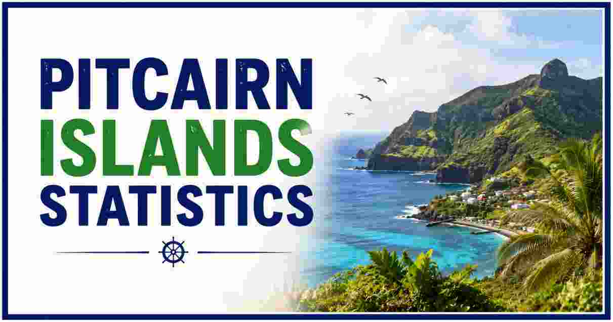
The Pitcairn Islands stand as the most remote inhabited territory administered by the United Kingdom, and one of the smallest and least populous jurisdictions found anywhere on Earth. Located deep in the South Pacific Ocean, roughly 5,500 kilometres from South America and 5,000 kilometres from New Zealand, this tiny British Overseas Territory consists of just four volcanic islands scattered across hundreds of miles of open water, with only one, Pitcairn Island itself, actually inhabited. As of 2026, official estimates place the total population at just 35 to 50 people, making it consistently ranked among the very smallest national or territorial populations tracked anywhere in the world.
This article lays out the most current, verified statistics for the Pitcairn Islands in 2026, sourced from the CIA World Factbook, the Pacific Community’s Statistics for Development Division, and official territorial records. Readers will find figures on location and geography, total land area across all four islands, population size and density, governance structure, economic indicators, and language and climate data. Every number reflects the latest published official and institutional data, giving researchers, geography enthusiasts, and anyone curious about this uniquely remote territory a single reliable reference point.
Because the Pitcairn Islands’ total population is so small, official figures can vary meaningfully depending on the exact source and reporting date, with recent estimates ranging from 35 to 50 residents. This variation is a natural byproduct of tracking a community this size, where the arrival or departure of even a single household can shift the reported total by several percentage points. Throughout this article, figures are presented alongside their specific source so readers can understand exactly which dataset and reporting period each number reflects.
Interesting Facts About the Pitcairn Islands in 2026
Before the detailed breakdown, here is a quick-reference table of standout figures defining this remote territory.
Key 2026 Pitcairn Islands Figures
Total Population                    ████░░░░░░░░░░░░░░░░░░░░░░░░░░░░░░░░░░░░ 35-50
Total Land Area (km²)                 ████████████████████████████████████████ 47
Number of Islands in Group              ████░░░░░░░░░░░░░░░░░░░░░░░░░░░░░░░░░░░░ 4
Distance from New Zealand (km)           ████████████████████████████████████████ 5,000
GDP Per Capita (USD)                      ████░░░░░░░░░░░░░░░░░░░░░░░░░░░░░░░░░░░░ $2,429
| Metric | Figure |
|---|---|
| Total population, 2026 | 35–50 (varies by source) |
| Total land area | 47 km² (18 sq mi) |
| Number of islands in the group | 4 (Pitcairn, Henderson, Ducie, Oeno) |
| Inhabited islands | 1 (Pitcairn Island only) |
| Capital and only settlement | Adamstown |
| Adamstown’s population rank among world capitals | 3rd smallest |
| Official languages | English and Pitkern |
| Official currency | New Zealand dollar (NZD) |
| GDP per capita | $2,429 (USD) |
| Population density | ~1 person per km² |
Source: The World Factbook (CIA), Pitcairn Islands profile, 2026; Pacific Community Statistics for Development Division, 2026; Wikipedia/Pitcairn Islands, citing 2023 population estimate.
These figures confirm that the Pitcairn Islands occupies a truly singular position among the world’s inhabited territories. With a population estimate ranging between 35 and 50 people depending on the specific data source and reporting year, it consistently ranks as one of the least populous jurisdictions on the planet, smaller than many individual apartment buildings in major cities worldwide. This tiny population is spread across a total land area of just 47 square kilometres, roughly one and a half times the size of Manhattan, split among four islands of which only one is actually home to permanent residents.
The territory’s isolation is perhaps its most defining characteristic: sitting roughly 5,500 kilometres from South America and 5,000 kilometres from New Zealand, the Pitcairn Islands has no direct neighbours of any kind, making it one of the most geographically remote inhabited places anywhere in the world. Its capital, Adamstown, holds the distinction of being the third-smallest national capital by population globally, while the territory’s modest GDP per capita of $2,429 reflects an economy built almost entirely around subsistence agriculture, fishing, limited tourism, and government administration rather than any large-scale commercial industry, a scale of economic activity that stands in stark contrast to far larger island economies covered in our Cabo Verde Population profile of another small island nation navigating similar development challenges.
Location and Geography of the Pitcairn Islands
Distance from Pitcairn Islands to Nearby Regions (km)
South America         ████████████████████████████████████████ 5,500 km
New Zealand             ████████████████████████████████████░░░ 5,000 km
| Geographic Metric | Figure |
|---|---|
| Region | Oceania (Polynesia subregion) |
| Distance from South America | ~5,500 km |
| Distance from New Zealand | ~5,000 km |
| Distance from Adamstown to New York City | ~9,340 km (5,804 mi) |
| Total coastline | 51 km (31.7 mi) |
| Highest elevation (Pitcairn Island) | 347 m (1,138 ft) |
| Number of nearby neighboring territories | 0 (no direct neighbors) |
| Time zone | UTC−08:00 |
Source: World Data Info, “Pitcairn Islands: country data and statistics,” 2026; Wikipedia/Pitcairn Islands.
The Pitcairn Islands occupies an extraordinarily isolated position within the South Pacific Ocean, situated in the Polynesia subregion of Oceania with no direct neighbouring countries or territories of any kind. This makes it one of the most genuinely remote inhabited places on the planet, a fact reflected in the sheer scale of the distances separating it from any other populated landmass: roughly 5,500 kilometres separate the islands from the nearest point in South America, while New Zealand, the territory’s closest source of regular supply and administrative support, lies approximately 5,000 kilometres away across open ocean.
Geographically, Pitcairn Island itself rises to a highest elevation of 347 metres at Pawala Valley Ridge, reflecting the island’s volcanic origins and rugged, cliff-lined coastline. The territory operates on its own dedicated time zone, UTC−08:00, and the total coastline across the inhabited island stretches to 51 kilometres, a relatively substantial shoreline given the island group’s tiny overall land area. This combination of extreme remoteness and rugged volcanic terrain has historically made both permanent settlement and routine transportation to and from the islands genuinely challenging, factors that continue to shape virtually every aspect of life and logistics on Pitcairn today.
Access to the islands remains almost entirely dependent on sea travel, since Pitcairn has no airstrip capable of handling regular passenger flights, meaning residents, supplies, and visitors alike must arrive by ship, typically via a periodic supply and passenger vessel connecting the territory to New Zealand and neighbouring French Polynesia. This transportation reality reinforces just how central the islands’ geographic isolation is to daily life, shaping everything from grocery delivery schedules to medical evacuation planning, and standing as perhaps the single most defining practical consequence of the territory’s position at one of the most remote points in the entire South Pacific Ocean.
Total Land Area and the Four Islands
Land Area by Island in the Pitcairn Group
Pitcairn Island (inhabited)   ██████████░░░░░░░░░░░░░░░░░░░░░░░░░░░░░░ 4.6 km²
Henderson Island                ████████████████████████████████████████ 37.3 km²
Oeno Island                       █░░░░░░░░░░░░░░░░░░░░░░░░░░░░░░░░░░░░░░░░ 0.65 km²
Ducie Island                       █░░░░░░░░░░░░░░░░░░░░░░░░░░░░░░░░░░░░░░░░ 0.7 km²
| Island | Approximate Land Area | Inhabited? |
|---|---|---|
| Pitcairn Island | 4.6 km² (1.8 sq mi) | Yes (sole inhabited island) |
| Henderson Island | ~37.3 km² (14.4 sq mi) | No (UNESCO World Heritage Site) |
| Ducie Island | ~0.7 km² | No |
| Oeno Island | ~0.65 km² | No |
| Total territory land area | 47 km² (18 sq mi) | — |
Source: The World Factbook (CIA), Pitcairn Islands profile, 2026; Wikipedia/Pitcairn Island.
The Pitcairn Islands territory is officially composed of four separate volcanic islands scattered across a wide expanse of the South Pacific: Pitcairn Island itself, along with the uninhabited Henderson, Ducie, and Oeno islands. Despite giving its name to the entire territory, Pitcairn Island is actually the smallest of the group’s larger landmasses by a significant margin, covering just 4.6 square kilometres, while Henderson Island is by far the largest at approximately 37.3 square kilometres, accounting for the majority of the territory’s total 47 square kilometre land area.
Henderson Island holds particular ecological significance despite being completely uninhabited, having been designated a UNESCO World Heritage Site in recognition of its largely undisturbed raised coral atoll ecosystem, one of the few remaining examples of this type of environment left relatively untouched by human activity anywhere in the world. The two smallest islands in the group, Ducie and Oeno, each cover less than one square kilometre and serve primarily as remote coral atolls with no permanent human presence, visited only occasionally by Pitcairn Island residents for fishing, harvesting, or scientific and conservation purposes, underscoring just how much of the territory’s official land area consists of essentially untouched wilderness rather than settled or developed land.
Population Size and Historical Trends
Pitcairn Island Population Over Time
1808 (post-settlement low point)   ████░░░░░░░░░░░░░░░░░░░░░░░░░░░░░░░░░░░░ 34
1937 (historical peak, approx.)      ████████████████████████████████████████ ~250
2008                                    ██████████░░░░░░░░░░░░░░░░░░░░░░░░░░░░░ 66
2026                                     ██████░░░░░░░░░░░░░░░░░░░░░░░░░░░░░░░░░░ 35-50
| Population Metric | Figure |
|---|---|
| Total population, 2026 (varies by source) | 35 to 50 |
| Adamstown population, 2026 estimate | 45 |
| Adamstown population, 2008 | 66 |
| Annual population change (recent estimate) | –1.87% to –1.96% |
| World population ranking by size | ~234th–245th |
| Population density | ~1 person per km² |
| Official language most widely spoken | English |
Source: World Population Review, “Adamstown Population 2026”; Pacific Community Statistics for Development Division, 2026; WorldStats.io, Pitcairn Islands Population 2026.
The Pitcairn Islands has experienced a gradual but persistent population decline over the past two decades, with the capital settlement of Adamstown, home to the entire territorial population, shrinking from 66 residents in 2008 to an estimated 45 people by 2026, an annual decline rate of roughly 1.87% to 1.96% depending on the specific dataset consulted. This slow, steady contraction places the Pitcairn Islands consistently near the very bottom of global population rankings, typically cited somewhere between 234th and 245th among all countries and territories tracked internationally.
With a total population hovering between 35 and 50 people and a land area of 47 square kilometres, the territory’s population density works out to approximately 1 person per square kilometre, among the lowest population densities of any inhabited territory in the Oceania region. Because virtually the entire population lives in the single settlement of Adamstown, the demographic data for the Pitcairn Islands is essentially a study of one small, close-knit community rather than a broader national population spread across multiple towns or regions, a characteristic that makes even minor changes, such as a single family departing or arriving, register as a meaningful percentage shift in the territory’s overall population figures.
Governance and Administration of the Pitcairn Islands
Pitcairn Islands Governance Structure
| Governance Metric | Figure |
|---|---|
| Sovereign state | United Kingdom |
| Government type | Devolved, locally governing dependency |
| Head of state | The Monarch (King Charles III) |
| Local governing body | Island Council |
| UK government minister responsible | Foreign, Commonwealth & Development Office minister |
| British colony status established | 30 November 1838 |
| UN member status | Non-self-governing territory (not a full UN member) |
| ISO country codes | PN / PCN |
Source: Wikipedia/Pitcairn Islands, citing official governance records; World Country Data, “Pitcairn Islands Population 2026.”
The Pitcairn Islands operates as a devolved, locally governing dependency of the United Kingdom, with day-to-day administration handled through a local Island Council while ultimate sovereignty and oversight remain with the British Crown, represented at the head-of-state level by the reigning Monarch. This governance arrangement, formally established when the islands became a British colony on 30 November 1838, combines a significant degree of local self-administration with the broader constitutional and diplomatic framework of a British Overseas Territory, overseen from London through a designated government minister responsible for the UK’s overseas territories.
As a non-self-governing territory, the Pitcairn Islands is not a full member of the United Nations, and its formal international identity is instead represented through internationally recognized ISO country codes PN and PCN, used for postal, telecommunications, and administrative purposes worldwide. This governance model, small in scale but structurally similar to arrangements used across other remote British territories, allows the Pitcairn Islands’ tiny resident population to manage local affairs through its own elected council structures while relying on the UK government for broader matters of defence, foreign affairs, and significant financial or infrastructure support, an administrative relationship comparable to the governance frameworks used across other small, remote island communities examined in our New Zealand Population Statistics coverage of a nearby Pacific nation with historic administrative and supply-chain ties to the Pitcairn Islands.
Economy and Living Conditions in the Pitcairn Islands
Pitcairn Islands Economic Snapshot
GDP Per Capita (USD)        ████░░░░░░░░░░░░░░░░░░░░░░░░░░░░░░░░░░░░ $2,429
| Economic Metric | Figure |
|---|---|
| GDP per capita | $2,429 (USD) |
| Official currency | New Zealand dollar (NZD) |
| World Bank income classification | Low-income economy |
| Primary economic activities | Subsistence agriculture, fishing, handicrafts, limited tourism |
| Internet access | Satellite Internet |
| Telecommunications | Telephone service; ham radio remains widely used |
| Trade arrangements | Bilateral agreements (non-UN member) |
Source: Pacific Community Statistics for Development Division, 2026; World Country Data, “Pitcairn Islands Population 2026,” citing World Bank data.
Economically, the Pitcairn Islands is classified by the World Bank as a low-income economy, with a GDP per capita of approximately $2,429, reflecting an economic base built almost entirely around small-scale subsistence agriculture, artisanal fishing, locally produced handicrafts, and a modest tourism trade centred on the territory’s unique history and remote natural environment. The islands use the New Zealand dollar as their official currency, a reflection of the close logistical, supply, and administrative ties between Pitcairn and New Zealand, which serves as the territory’s primary gateway for shipping, medical evacuation, and government communication given the impracticality of maintaining such services directly from the United Kingdom itself.
Despite its remote location and minimal economic infrastructure, the Pitcairn Islands maintains modern telecommunications access, including satellite Internet and standard telephone service, even though ham radio continues to play a meaningful supplementary role in day-to-day communication, a practical necessity given the territory’s isolation from conventional telecommunications infrastructure. As a non-UN member territory, Pitcairn’s trade relationships operate through bilateral agreements rather than participation in broader multilateral trade frameworks, meaning virtually all significant imported goods, from fuel to construction materials to specialized foodstuffs, arrive via periodic supply shipments coordinated through New Zealand rather than through any form of direct commercial shipping route.
Language, Currency, and Daily Life in the Pitcairn Islands
Official Languages of the Pitcairn Islands
English    ████████████████████████████████████████ Primary official language
Pitkern    ████████████████████░░░░░░░░░░░░░░░░░░░░ Secondary official/local language
| Language or Cultural Metric | Figure |
|---|---|
| Official languages | English, Pitkern |
| Demonym(s) | Pitcairn Islanders, Pitkern, Pitcairnese |
| Local anthem | “Come Ye Blessed” |
| National anthem (as UK territory) | “God Save the King” |
| Ethnic group | Pitcairn Islanders |
| Adamstown established | 15 January 1790 |
| Adamstown became formal settlement/capital | 1838 (British colony status) |
Source: Wikipedia/Pitcairn Islands; Wikipedia/Adamstown, Pitcairn Islands.
Language on the Pitcairn Islands reflects the territory’s unique settlement history, with residents officially speaking both English and Pitkern, a distinctive English-based creole language that developed among the island’s original settler community and continues to be spoken locally alongside standard English today. This dual-language identity is further reflected in the territory’s cultural symbols, which include both “God Save the King” as the formal anthem befitting its status as a British Overseas Territory, and “Come Ye Blessed” as a distinct local anthem specific to the Pitcairn Islands community itself.
Residents of the territory are formally known by several related demonyms, including Pitcairn Islanders, Pitkern, and Pitcairnese, terms that reflect the singular, closely-knit ethnic and cultural identity of the small community that has called these remote islands home since Adamstown’s establishment on 15 January 1790. This settlement date, predating the islands’ formal designation as a British colony by nearly five decades in 1838, underscores just how long a continuous, if extremely small, community has maintained a permanent presence on Pitcairn Island, making it one of the most historically enduring, if population-wise smallest, settled communities anywhere in the South Pacific region.
Climate and Environment of the Pitcairn Islands
Adamstown Average Monthly Precipitation (mm)
Annual Total    ████████████████████████████████████████ 1,542.7 mm
| Climate or Environment Metric | Figure |
|---|---|
| Climate classification | Tropical rainforest climate (Af) |
| Annual average precipitation | 1,542.7 mm (60.74 in) |
| Highest monthly rainfall (December) | 157.7 mm |
| Lowest monthly rainfall (January) | 96.5 mm |
| UNESCO World Heritage status | Henderson Island (designated for ecological significance) |
| Dominant terrain type | Volcanic, rugged cliff coastline |
Source: Wikipedia/Adamstown, Pitcairn Islands, citing official climate data tables.
The Pitcairn Islands experiences a tropical rainforest climate, classified under the Köppen system as Af, characterized by consistently warm temperatures and substantial year-round rainfall totalling approximately 1,542.7 millimetres annually. Rainfall is distributed relatively evenly across the calendar, though the wettest month, December, typically records around 157.7 millimetres, compared to the driest month, January, at approximately 96.5 millimetres, a pattern that reflects the islands’ position within the broader South Pacific tropical weather system.
Environmentally, the territory’s ecological significance extends well beyond its tiny inhabited area, most notably through Henderson Island’s designation as a UNESCO World Heritage Site, recognized for hosting one of the world’s few remaining largely undisturbed raised coral atoll ecosystems. Combined with the rugged, volcanic terrain that defines Pitcairn Island itself, this environmental profile makes the territory a location of genuine scientific and conservation interest, even as its practical significance to most of the outside world remains centred on its status as one of the smallest, most remote, and most sparsely populated inhabited places found anywhere on the planet.
Taken together, the geographic, demographic, economic, and environmental statistics presented throughout this article paint a consistent picture: the Pitcairn Islands functions as a uniquely small-scale, tightly interconnected community shaped fundamentally by its extreme isolation. From a population that can be counted in the dozens rather than thousands, to an economy built on subsistence activities rather than large-scale industry, to a governance structure that blends local self-administration with distant British oversight, every dimension of life on Pitcairn reflects the practical realities of maintaining a permanent human settlement at one of the most remote points on Earth. As official data collection continues through the Pacific Community and periodic UK government reporting, these figures are likely to remain broadly stable in scale, even as the precise population count continues its gradual, decade-long decline documented in the most recent estimates.
Disclaimer: The data research report we present here is based on information found from various sources. We are not liable for any financial loss, errors, or damages of any kind that may result from the use of the information herein. We acknowledge that though we try to report accurately, we cannot verify the absolute facts of everything that has been represented.