
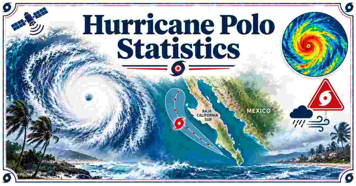
Hurricane Polo reached Category 5 strength three separate times in September 2026, peaking at 180 mph winds and a central pressure of 892 mbar, making it the second-most intense Eastern Pacific hurricane ever recorded. Polo made two landfalls in northwestern Mexico on September 28-29, first in Baja California Sur as a Category 2 storm, then near Guaymas, Sonora as a Category 1.
Hurricane Polo – Introduction
Hurricane Polo rewrote the record books for the Eastern Pacific basin in September 2026. It formed as Tropical Depression Seventeen-E off Mexico’s Pacific coast on September 20, and within a single day it gained 110 mph in wind speed, one of the fastest intensification rates ever recorded in the basin. By September 22, Polo had reached Category 5 status with 180 mph sustained winds, a peak intensity it would touch two more times before finally weakening for good, an achievement no other Pacific hurricane has matched in one lifecycle.
Polo was the 18th named storm, 7th hurricane, 5th major hurricane, and record-tying 3rd Category 5 hurricane of the 2026 Pacific hurricane season. Its central pressure of 892 mbar places it second only to Hurricane Patricia’s 2015 record among Eastern Pacific storms. This report compiles the verified data on Polo’s wind speed, path, landfalls, casualties, and damage as the storm’s remnants move into the southwestern United States. Every figure below comes from the National Hurricane Center, the Mexican government’s civil protection agencies, and named wire-service reporting, not from independent estimates.
What makes Polo especially notable is that its peak intensity and its landfall intensity told two very different stories. A storm that spends part of its life at Category 5 does not necessarily strike land at anywhere near that strength, and Polo is a clear example: by the time its center reached the Mexican coast, cooler water and land interaction with the Baja California peninsula had already stripped away more than 100 mph of wind speed from its offshore peak. That gap between a hurricane’s maximum lifetime intensity and its landfall intensity is one of the most consequential, and most commonly misunderstood, distinctions in any storm’s public record.
Interesting Facts About Hurricane Polo 2026
HURRICANE POLO 2026: STORM PROFILE AT A GLANCE
Peak winds (Cat 5, Sept 22)       ██████████████████████ 180 mph
1st landfall (Cat 2, Sept 28-29)  ████████████████ 96-110 mph
2nd landfall (Cat 1, Sept 29)     █████████ 75 mph
Confirmed fatalities █ 2| Interesting Fact | 2026 Figure |
|---|---|
| Formed | September 20, 2026, as Tropical Depression Seventeen-E |
| Peak intensity | Category 5, 180 mph winds, 892 mbar pressure, September 22 |
| Basin ranking | 2nd-most intense Eastern Pacific hurricane on record, behind Patricia (2015) |
| Category 5 status reached | 3 separate times during its lifecycle, a Pacific hurricane record |
| Rapid intensification | Gained 110 mph in wind speed in 24 hours |
| Season designation | 18th named storm, 7th hurricane, 5th major hurricane, 3rd Cat 5 of 2026 |
| First landfall | Near Las Barrancas, Baja California Sur, Category 2, ~96-110 mph |
| Second landfall | Near Guaymas, Sonora, Category 1, ~75 mph |
| Confirmed fatalities | 2; 1 missing |
Source: National Hurricane Center; Wikipedia (Hurricane Polo); AccuWeather; ABC News, September 2026.
Polo’s 892 mbar central pressure at peak intensity puts it in exclusive company: only Hurricane Patricia, which struck the same general region in 2015 with a record 872 mbar reading, has ever recorded a lower pressure in the Eastern Pacific basin. Reaching Category 5 strength three separate times in one lifecycle is itself unprecedented for a Pacific hurricane, a pattern driven by repeated weakening over cooler water followed by renewed strengthening as Polo moved back over warmer stretches of ocean.
Despite that historic intensity, Polo’s landfall toll has so far been comparatively limited. The storm made its first landfall in Baja California Sur as a weakened Category 2 system, and its second in Sonora as a Category 1, sparing mainland Mexico the full force of its earlier peak. Confirmed fatalities stand at 2, with 1 person still missing, figures that reflect substantial evacuation and preparation efforts across the storm’s path even as damage assessments in Sonora remain incomplete.
Hurricane Polo Wind Speed and Intensity Timeline 2026
| Date | Status | Max Sustained Winds | Pressure |
|---|---|---|---|
| September 20, 2026 | Tropical depression forms | Under 40 mph | N/A |
| September 21, 2026, 18:00 UTC | Category 1 hurricane | 130 km/h (81 mph); gusts 150 km/h | 978 mb |
| September 22, 2026, 12:00 UTC | Peak: Category 5 | 180 mph (285 km/h) | 892 mb |
| September 23, 2026, 12:00 UTC | Category 4 | 241 km/h (150 mph); gusts 277 km/h | 925 mb |
| September 24, 2026, 00:00 UTC | Restrengthens to Category 5 | Up to 259 km/h | N/A |
| September 26, 2026, 18:00 UTC | Category 4 | 232 km/h; gusts 267 km/h | 938 mb |
| September 27, 2026 | Weakens to Category 3 | 204 km/h, down from 232 six hours earlier | N/A |
| September 29, 2026, 12:00 UTC | Weakens to Category 1 | 120 km/h | 981 mb |
Source: RainViewer Hurricane Tracker (NHC advisory data); Wikipedia; zoom.earth storm archive, September 2026.
Polo’s intensity swung dramatically across its nine-day lifecycle. After forming on September 20, it needed barely a day to reach hurricane strength, then continued strengthening explosively to reach Category 5 by September 22 with 180 mph winds. The storm weakened to Category 4 by September 23 as it crossed cooler water, then defied the typical pattern by restrengthening back to Category 5 at 00:00 UTC on September 24, before losing strength again within twelve hours.
A second weakening trend set in after September 24, with Polo holding Category 4 strength through September 26 before dropping to Category 3 on September 27 and continuing a steady decline through Category 2 and finally Category 1 by September 29, just before its two landfalls in Mexico. That zigzag pattern, five separate intensity changes in category over nine days, made Polo one of the more difficult storms of the 2026 season to forecast precisely, even as its overall downward trend toward landfall remained consistent.
Forecasters at the National Hurricane Center tracked Polo through more than two dozen advisories over its lifetime, updating wind speed and pressure readings roughly every six hours as the storm moved. That six-hour advisory cadence is the standard the agency uses for any active hurricane in the Eastern Pacific, and it’s why the intensity table above shows readings clustered at 00:00, 06:00, 12:00, and 18:00 UTC rather than a continuous curve; each entry reflects the agency’s official assessment at that specific advisory time rather than a live, constantly updating figure.
Hurricane Polo Path and Landfall Timeline 2026
HURRICANE POLO: TRACK TIMELINE, 2026
Sep 20  Forms off Mexico's Pacific coast
Sep 22  Peaks offshore southwestern Mexico
Sep 26-28  Tracks north-northwest toward Baja California
Sep 28 (Mon night)  1st landfall: Las Barrancas, Baja California Sur
Sep 29 (Tue midday)  2nd landfall: near Guaymas, Sonora
Sep 29 (Tue evening)  Weakens to tropical storm, moves inland
Sep 30+  Remnants track into New Mexico, Texas, southern Plains
| Date | Location / Milestone |
|---|---|
| September 20, 2026 | Forms as Tropical Depression Seventeen-E off Mexico’s Pacific coast |
| September 22, 2026 | Peaks at Category 5 offshore southwestern Mexico |
| September 26-28, 2026 | Tracks north-northwest toward the Baja California Peninsula |
| September 28, 2026 (late night) | First landfall near Las Barrancas, Comondú, Baja California Sur, as Category 2 |
| September 29, 2026 (midday) | Second landfall near Guaymas, Sonora, as Category 1 |
| September 29, 2026 (evening) | Weakens to tropical storm as it moves farther inland |
| September 30, 2026 onward (forecast) | Remnants track into New Mexico, Texas, and the southern Plains |
Source: ABC News; CBC News; AccuWeather; National Hurricane Center advisories, September 2026.
Polo’s overall track carried it from its formation point off Mexico’s Pacific coast on September 20 in a long northward arc, first out over open water where it reached its Category 5 peak, then back toward the coast as it weakened. Its first landfall came late Monday night, September 28, near Las Barrancas in the municipality of Comondú, Baja California Sur, as a Category 2 hurricane packing winds of 96 to 110 mph.
After crossing the peninsula and the Gulf of California, Polo made a second landfall around midday on Tuesday, September 29, near the port city of Guaymas in Sonora state, by then weakened to a Category 1 hurricane with sustained winds around 75 mph. The storm continued to weaken rapidly as it moved farther inland through the evening, and its remnants were forecast to move rapidly northeastward into the southwestern United States, bringing heavy rainfall and flash-flood risk to southern New Mexico, western Texas, and the southern Plains into midweek.
The crossing of the Gulf of California between Polo’s two landfalls mattered meteorologically as much as geographically. The Gulf’s waters, while generally warm, are shallower and more easily churned by a passing storm than the open Pacific, and Polo’s brief time over that stretch of water did not allow the storm to regain the strength it had lost crossing the Baja California peninsula. That is part of why Sonora, despite sitting directly across the Gulf from Polo’s first landfall point, ultimately absorbed a considerably weaker system than Baja California Sur did the night before.
Hurricane Polo Casualties and Evacuations in Mexico 2026
HURRICANE POLO: SHELTER AND CASUALTY FIGURES
Sheltered in Baja California Sur   ███████████████████████ ~700 people
Sheltered in Sonora                ██████████████████ 543 people
Confirmed fatalities               ██  2
Missing                            █  1
| Casualty/Evacuation Metric | Figure |
|---|---|
| Confirmed fatalities | 2 |
| Missing | 1 |
| Deaths reported in Baja California Sur | 0, per state civil protection |
| People sheltered, Baja California Sur | Nearly 700 |
| People sheltered, Sonora | 543 |
| Municipalities with ordered evacuations, Sonora | Guaymas, Empalme, Benito Juárez, Vícam |
| Ports closed ahead of landfall | Multiple, Baja California region |
Source: Wikipedia (Hurricane Polo); Rio Times Online; CBC News; national civil protection coordinator Laura Velázquez.
Mexico’s national civil protection coordinator, Laura Velázquez, confirmed no deaths in Baja California Sur despite the state absorbing Polo’s stronger, Category 2 first landfall, a result state officials attributed to preparation measures including port closures announced days ahead of the storm’s arrival. Nearly 700 people sheltered in Baja California Sur, while 543 people sought shelter in Sonora as the storm’s second landfall approached, with state authorities ordering evacuations across the municipalities of Guaymas, Empalme, Benito Juárez, and Vícam.
Despite the localized reports of zero deaths in the hardest-hit Mexican states, Wikipedia’s consolidated storm summary lists 2 confirmed fatalities and 1 person missing for Polo overall, figures that reflect impacts recorded elsewhere along the storm’s broader path beyond the two immediate landfall zones. As is typical in the immediate aftermath of a major storm, casualty figures can shift as search-and-rescue operations continue and more remote areas are reached; readers should treat any total beyond the confirmed count as provisional.
Hurricane Polo Rainfall, Flooding and Damage in Mexico 2026
HURRICANE POLO: RAINFALL FORECAST FOR SONORA (inches)
Widespread total       █████  4-6 in
Isolated maximum       ████████  8 in
| Impact Category | Figure |
|---|---|
| Rainfall forecast, southern/central Sonora | 4 to 6 inches, isolated totals to 8 inches |
| Rainfall in metric terms | 10 to 15 cm, isolated maximum 20 cm |
| Guaymas flooding | City center, malecón, and municipal palace flooded |
| Baja California Sur damage | Streets flooded, trees snapped; material inventory still being compiled |
| Sonora damage assessment | No official figure published as of this writing |
| Aid delivered (Mexican Navy) | 2,000 food baskets, 8,000 liters of drinking water |
Source: National Hurricane Center; CBC News; Rio Times Online, September 29, 2026.
Polo’s rainfall in Sonora was forecast at 4 to 6 inches across southern and central portions of the state, with isolated totals reaching 8 inches, enough to flood the city center of Guaymas, including its malecón waterfront and municipal palace, as the storm’s second landfall moved through. In Baja California Sur, Polo’s first landfall turned streets into rivers and snapped trees across the peninsula, though the state’s material damage inventory remained incomplete as of the storm’s second landfall the following day.
Both Sonora and Baja California Sur had published no official damage total as of this writing, and outlets covering the storm’s aftermath explicitly noted the preliminary nature of any figures circulating in the immediate aftermath. Mexico’s Secretariat of the Navy moved quickly on relief logistics regardless, delivering 2,000 food baskets, 8,000 liters of drinking water, and heavy machinery to the affected region by ship even before full damage assessments were complete. That gap between confirmed relief logistics and confirmed damage totals is a normal feature of major-storm reporting in its first 24 to 48 hours: aid deliveries can be counted and reported almost immediately, while a full damage inventory requires inspectors to physically reach every affected community, a process that in a region as geographically spread out as coastal Sonora and Baja California Sur can take days or weeks to complete. Readers evaluating storm-driven property risk more broadly can find useful context in the business insurance statistics for the US, which detail how commercial property pricing continues shifting in storm-exposed coastal markets even outside the Pacific basin.
Hurricane Polo in the 2026 Pacific Hurricane Season Context
| Season Context Metric | Figure |
|---|---|
| Polo’s designation | 18th named storm, 7th hurricane, 5th major hurricane of 2026 |
| Category 5 hurricanes, 2026 Pacific season | 3 (tying the all-time record) |
| Prior Cat 5 storms this season | Hurricane Genevieve (first, July), Hurricane Lowell (second, September) |
| Season start / scheduled end | May 15, 2026 / November 30, 2026 |
| Season total damage (2026 USD) | More than $682 million |
| Hurricane Lowell’s distinction | First hurricane to directly impact Kauaʻi County since Hurricane Iniki (1992) |
Source: Wikipedia (2026 Pacific hurricane season); National Hurricane Center season archive.
Polo’s Category 5 peak made it the third storm of the 2026 Pacific season to reach that intensity, tying the all-time record for Category 5 hurricanes in a single Pacific season. It followed Hurricane Genevieve, which became the season’s first major hurricane and first Category 5 in July, and Hurricane Lowell, which reached Category 5 in September and became the first hurricane to directly strike Hawaii’s Kauaʻi County since Hurricane Iniki in 1992. Three Category 5 storms in one season underscores how active the 2026 Eastern Pacific season became by its final months.
The 2026 Pacific hurricane season, which runs from May 15 to November 30, had already produced more than $682 million in total damage across all its storms even before Polo’s full impact was tallied, a figure that will almost certainly rise once Sonora and Baja California Sur publish their own damage assessments from Polo specifically. With more than two months still remaining on the official season calendar after Polo’s landfall, that $682 million running total is itself a snapshot rather than a final figure, subject to revision both from Polo’s own pending damage assessment and from any further storms that develop before the season closes on November 30. For broader context on how a season like this compares with land-based disaster costs in the US, the wildfire statistics for the United States offer a useful point of comparison for how quickly a single active season’s damage total can climb once every incident is accounted for, and the hurricane statistics for the United States put Polo’s Eastern Pacific intensity in context against the costliest and deadliest storms to strike US shores historically.
Hurricane Polo FAQs
How strong did Hurricane Polo get?
Polo peaked at Category 5 strength with 180 mph sustained winds and a central pressure of 892 mbar on September 22, 2026.
Is Hurricane Polo the strongest Pacific hurricane ever?
No. It is the second-most intense Eastern Pacific hurricane on record by central pressure, behind Hurricane Patricia (2015, 872 mbar).
Where did Hurricane Polo make landfall?
Twice: first near Las Barrancas, Baja California Sur as a Category 2 hurricane, then near Guaymas, Sonora as a Category 1 hurricane.
How many people died in Hurricane Polo?
2 confirmed fatalities and 1 person missing, according to consolidated storm records, though the hardest-hit states of Baja California Sur and Sonora reported no local deaths.
Did Hurricane Polo reach Category 5 more than once?
Yes. Polo reached Category 5 strength three separate times, a record for a single Pacific hurricane’s lifecycle.
How fast did Hurricane Polo intensify?
It gained 110 mph in wind speed within 24 hours, one of the fastest intensification rates ever recorded in the Eastern Pacific.
What category was Hurricane Polo when it hit the US?
Polo did not make landfall in the US as a hurricane. Its remnants brought heavy rain and flash-flood risk to New Mexico, Texas, and the southern Plains after weakening to a tropical storm over Mexico.
How much damage did Hurricane Polo cause?
Official damage totals for Baja California Sur and Sonora had not been published as of this writing; the broader 2026 Pacific season had recorded more than $682 million in damage before Polo’s full impact was assessed.
How many storms have been Category 5 in the 2026 Pacific season?
3: Hurricane Genevieve, Hurricane Lowell, and Hurricane Polo, tying the all-time record for a single Pacific season.
How many people evacuated ahead of Hurricane Polo?
Nearly 700 sheltered in Baja California Sur and 543 in Sonora as the storm approached.
When did Hurricane Polo form?
September 20, 2026, as Tropical Depression Seventeen-E off Mexico’s Pacific coast.
Is Hurricane Polo season over?
No. The 2026 Pacific hurricane season runs through November 30, so additional storms remain possible after Polo.
Disclaimer: The data research report we present here is based on information found from various sources. We are not liable for any financial loss, errors, or damages of any kind that may result from the use of the information herein. We acknowledge that though we try to report accurately, we cannot verify the absolute facts of everything that has been represented.