Where Is the Gulf of America?
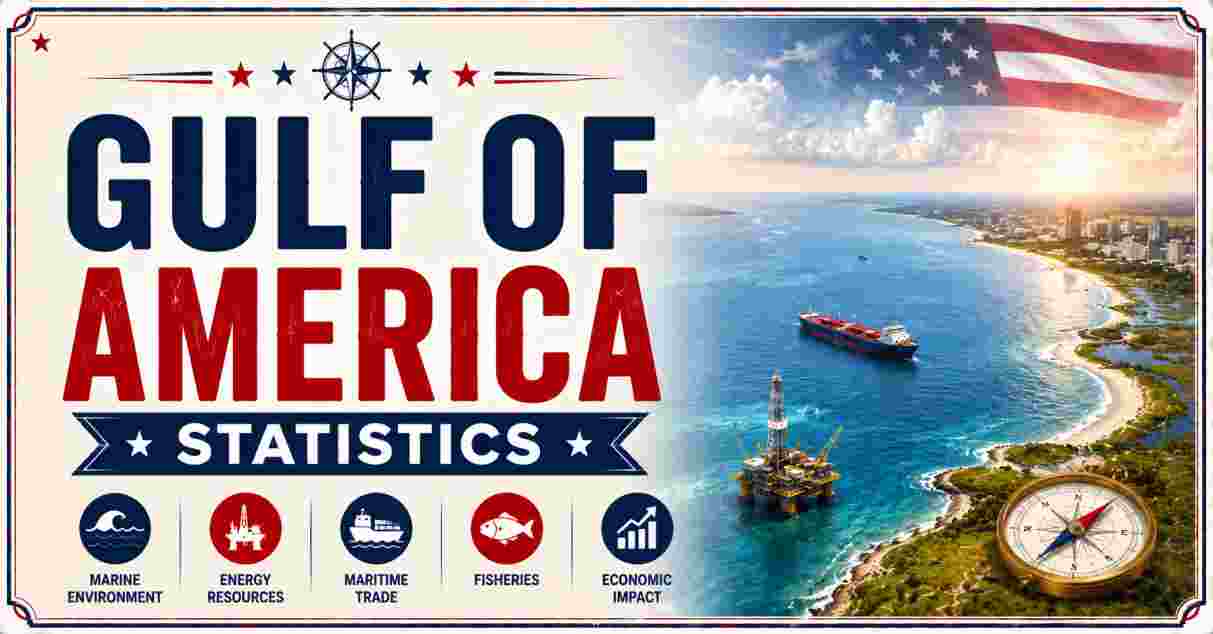
The Gulf of America is the current official US federal name for the large marginal sea bordered by the United States, Mexico, and Cuba, previously known internationally as the Gulf of Mexico. The renaming took effect following Executive Order 14172, signed in January 2025, which directed all US federal agencies to update maps, charts, and official documents to reflect the new name. Covering roughly 600,000 square miles, it remains the ninth-largest body of water on Earth and the largest gulf in the world, connected to the Atlantic Ocean through the Straits of Florida and to the Caribbean Sea via the Yucatán Channel. Major US coastal cities including Houston, New Orleans, Tampa, and Corpus Christi sit along its shores.
Beyond geography, the Gulf of America functions as one of the most economically significant bodies of water in the country, driving hundreds of billions of dollars annually through offshore oil and gas production, commercial and recreational fishing, and coastal tourism. Its warm, relatively shallow continental shelf waters transition into the dramatic depths of the Sigsbee Deep, while its position at the base of the Mississippi River drainage makes it central to both American energy production and the health of the nation’s largest estuarine ecosystem. This article compiles the most current, verified 2026 statistics on the Gulf of America’s size, depth, oil output, fishing economy, and naming history, drawn from federal agencies including NOAA, the EIA, and BOEM, along with leading US and international reference sources.
Interesting Facts About the Gulf of America (2026)
| Fact | Detail |
|---|---|
| Surface area | 600,000 sq mi (1,550,000 km²) |
| Global size rank | 9th-largest body of water on Earth |
| Average depth | ~5,200–5,300 feet |
| Deepest point (Sigsbee Deep) | ~14,383–17,070 feet |
| Bordering countries | US, Mexico, Cuba |
| East-west span | ~932 miles |
| 2026 offshore crude oil production | 1.81–1.96 million barrels/day |
| Renamed via | Executive Order 14172, January 2025 |
| Annual fishing industry value | ~$680 billion |
| Estimated undiscovered oil (technically recoverable) | 29.59 billion barrels |
Source: Britannica, NOAA, US Energy Information Administration, Bureau of Ocean Energy Management
As a content writer, what stands out immediately in this table is the sheer scale of the Gulf on multiple fronts at once: it’s the 9th-largest body of water in the world, it holds enough undiscovered oil to matter on a national scale at 29.59 billion barrels, and its fishing economy alone is valued at roughly $680 billion annually. Few bodies of water anywhere combine this level of geographic scale with this degree of direct economic importance to a single country’s energy and food supply.
The table also highlights just how significant the January 2025 renaming was as a piece of federal policy, even though it changed nothing about the water itself. The Gulf’s physical statistics — its 600,000-square-mile surface, its 17,070-foot maximum depth at Sigsbee Deep — remain identical to what they were under the name Gulf of Mexico; only the official US federal terminology changed. The sections below break down each of these figures in detail, from geography and depth to the oil industry and fishing economy that depend on this water body every day.
Gulf of America Size and Area Statistics 2026
| Metric | Figure |
|---|---|
| Total surface area | 600,000 sq mi (1,550,000 km²) |
| Global rank by size | 9th-largest water body on Earth |
| East-west extent | ~1,100 miles (1,800 km) |
| North-south extent | ~800 miles (1,300 km) |
| Alternative east-west figure (coastal measurement) | ~932 miles |
| Estimated total water volume | Over 660 quadrillion gallons |
Source: Encyclopaedia Britannica, WorldAtlas, American Oceans
Gulf of America size comparison (sq mi):
Gulf of America:  ##################  600,000
At 600,000 square miles, the Gulf of America is officially recognized as the 9th-largest body of water in the world and the largest gulf on the planet, larger than many entire countries combined. Its dimensions vary slightly depending on the measurement methodology used — Britannica lists east-west and north-south extents of roughly 1,100 by 800 miles, while other coastal survey sources cite a slightly smaller east-west span of about 932 miles — but all sources agree on its status as one of the largest marginal seas anywhere on Earth.
This scale is what allows the Gulf to function simultaneously as a major oil-producing region, a critical fishing ground, and a hurricane incubator, since a body of water this large touches so many distinct ecological and economic zones at once. With an estimated 660 quadrillion gallons of water, the Gulf’s sheer volume also plays a stabilizing role in regional climate, moderating temperatures across the Gulf Coast states and feeding the moisture that fuels both beneficial rainfall and the tropical storm systems the region is known for.
Gulf of America Depth Statistics 2026
| Metric | Figure |
|---|---|
| Average depth | ~5,200–5,300 feet (1,615 m) |
| Maximum depth (Sigsbee Deep) | ~14,383–17,070 feet (4,384–5,203 m) |
| Deepest point location | Mexico Basin, southwestern Gulf |
| Continental shelf characteristic | Relatively shallow along coastal margins |
| Depth rank comparison | Deeper than Lake America (802 ft) by a factor of over 17x |
Source: Encyclopaedia Britannica, WorldAtlas, americanoceans.org
Gulf of America depth profile:
Average depth:    ###########  5,200 ft
Maximum depth:    ###################################  17,070 ft
The gap between the Gulf’s average depth of roughly 5,200 feet and its maximum depth at Sigsbee Deep, which sources place between 14,383 and 17,070 feet, reflects the Gulf’s dramatic underwater topography. While its coastal continental shelf areas remain relatively shallow — a characteristic that supports much of the Gulf’s fishing and near-shore oil infrastructure — the seafloor drops sharply toward the Mexico Basin in the southwestern Gulf, where Sigsbee Deep represents one of the most significant depth features in the entire Western Hemisphere.
This depth variation directly shapes where and how offshore energy companies operate. Shallow shelf waters host the traditional platforms most associated with Gulf oil production, while the deepwater and ultra-deepwater zones near Sigsbee Deep have become the frontier of modern drilling technology, with companies now deploying 20,000 psi-rated equipment specifically to access reserves at depths that were commercially unreachable just a decade ago.
Gulf of America Coastline and Bordering States Statistics 2026
| Metric | Figure |
|---|---|
| Bordering countries | United States, Mexico, Cuba |
| US Gulf Coast states | Texas, Louisiana, Mississippi, Alabama, Florida |
| Total coastline length (US, Mexico, Cuba combined) | ~3,100 miles (5,000 km) |
| Major connecting waterways | Straits of Florida (to Atlantic), Yucatán Channel (to Caribbean) |
| Major rivers draining into the Gulf | Mississippi River, Rio Grande |
| Largest US coastal cities on the Gulf | Houston, New Orleans, Tampa, Corpus Christi |
Source: Wikipedia Gulf of Mexico geographic data, Encyclopaedia Britannica
US Gulf Coast states (west to east):
Texas → Louisiana → Mississippi → Alabama → Florida
Five US states — Texas, Louisiana, Mississippi, Alabama, and Florida — share a coastline along the Gulf of America, collectively forming one of the most economically important stretches of shoreline in the country. This five-state Gulf Coast region hosts a dense concentration of ports, refineries, and fishing communities, anchored by major metropolitan areas including Houston and New Orleans, both of which rank among the busiest ports in the United States by cargo tonnage.
The Gulf’s connection to the wider ocean system through the Straits of Florida and the Yucatán Channel makes it a critical link in North American and international shipping, while the Mississippi River’s outflow into the Gulf makes the entire body of water the terminal basin for roughly 40% of the continental United States’ drainage. That concentration of freshwater inflow, sediment, and nutrients has historically made Gulf coastal waters exceptionally productive for fisheries, even as it has also contributed to well-documented seasonal hypoxic “dead zones” near the Mississippi Delta.
Gulf of America Naming and Renaming Statistics 2026
| Metric | Detail |
|---|---|
| Renaming order | Executive Order 14172 |
| Date signed | January 2025 |
| Federal agencies affected | All agencies; maps, charts, official documents updated |
| International recognition status | US federal usage only; most other countries retain “Gulf of Mexico” |
| Comparable 2026 renaming precedent | Lake Ontario → “Lake America”, August 27, 2026 |
| GNIS database update requirement (comparable order) | Within 30 days |
Source: White House Executive Order 14172, Britannica, Associated Press
US federal geographic renamings timeline:
Jan 2025:  Gulf of Mexico → Gulf of America (Executive Order 14172)
Aug 2026:  Lake Ontario → Lake America (Executive Order)
The Gulf of America renaming, formalized under Executive Order 14172 in January 2025, directed every US federal agency to adopt the new name across maps, contracts, and official communications, even though the change carries no binding authority over how other nations or international mapmaking bodies refer to the same body of water. This pattern — a US-only administrative renaming with no effect on the physical geography or international terminology — has since been repeated with other US bodies of water; most recently, the smallest of the Great Lakes was renamed Lake America in a separate executive order signed in August 2026, explicitly citing the earlier Gulf renaming as a direct precedent.
Because the renaming only binds US federal usage, publications, mapping services, and government bodies outside the United States have varied in whether they adopt “Gulf of America” or continue using “Gulf of Mexico,” creating a situation where the same body of water carries two officially recognized names depending on which country’s institutions are referencing it. This dual-name reality is now a defining feature of how the Gulf is discussed in US media, government documents, and international reporting alike heading into the second half of 2026.
Gulf of America Oil Production Statistics 2026
| Metric | Figure |
|---|---|
| 2025 crude oil production (federal offshore) | 1.80 million barrels/day |
| 2026 forecast crude oil production | 1.81 million barrels/day |
| Share of total US crude oil production | ~13% |
| 2026 natural gas production | 1.64 billion cubic feet/day |
| Share of total US marketed natural gas production | ~1% |
| New fields commencing production, 2025–2026 | 13 fields |
| Projected production by 2027 | Up to 2.4 million barrels/day |
Source: US Energy Information Administration (EIA), Bureau of Ocean Energy Management (BOEM)
Gulf of America crude oil production (million barrels/day):
2024            :  #################  1.77
2025            :  ##################  1.80
2026            :  ##################  1.81
2027 (projected):  ########################  2.4
The US Energy Information Administration forecasts that federal offshore Gulf of America crude oil production will average 1.81 million barrels per day in 2026, a modest increase over 1.80 million barrels per day in 2025 and 1.77 million in 2024, driven largely by 13 new fields scheduled to begin production across 2025 and 2026. At these volumes, the Gulf continues to supply roughly 13% of all US crude oil production, a remarkably stable contribution given the broader volatility in national energy markets.
Longer-term projections suggest this growth trajectory could accelerate significantly: the EIA and BOEM estimate Gulf output could climb to as much as 2.4 million barrels per day by 2027, driven by high-pressure deepwater drilling technology capable of accessing previously unreachable reserves. Major operators including Chevron and BP have already begun deploying 20,000 psi-rated equipment in the Gulf, with Chevron alone projecting its own Gulf production will reach 300,000 barrels of oil equivalent per day in 2026, a 50% increase over just two years.
Gulf of America Oil Reserves Statistics 2026
| Metric | Figure |
|---|---|
| Estimated technically recoverable oil (undiscovered) | 29.59 billion barrels |
| Range of estimates | 23.31–36.27 billion barrels |
| Estimated technically recoverable natural gas | 54.84 trillion cubic feet |
| Range of gas estimates | 46.88–62.56 trillion cubic feet |
| 2023 resource assessment increase | +22.6% (1.3 billion barrels of oil equivalent added) |
| Reservoirs analyzed in 2023 update | 37,000+ across 1,336 fields |
Source: Bureau of Ocean Energy Management (BOEM) 2021/2023 Resource Assessments
BOEM technically recoverable oil estimate range:
Low:       #########################  23.31 billion bbl
Expected:  ###############################  29.59 billion bbl
High:      #################################  36.27 billion bbl
The Bureau of Ocean Energy Management estimates the Gulf of America holds an expected 29.59 billion barrels of technically recoverable, undiscovered oil, with estimates ranging as high as 36.27 billion barrels depending on exploration outcomes and technology assumptions. A comprehensive 2023 resource assessment update, which analyzed more than 37,000 reservoirs across 1,336 fields, increased the prior estimate by 22.6%, reflecting how quickly advances in deepwater geological modeling are reshaping understanding of what the Gulf’s subsurface actually holds.
These reserve figures are what make continued deepwater investment in the Gulf economically rational even amid volatile oil prices, since a resource base of this size supports decades of potential future production. The accompanying natural gas estimate of 54.84 trillion cubic feet further reinforces the Gulf’s long-term significance to US energy security, positioning it as one of the few domestic regions capable of meaningfully growing both oil and gas output simultaneously well into the 2030s.
Gulf of America Fishing and Seafood Industry Statistics 2026
| Metric | Figure |
|---|---|
| Annual fishing industry value | ~$680 billion |
| Share of total US annual fishing yield | ~40% |
| Shrimp industry value (Gulf-specific) | ~$400 billion |
| Commercial fishing jobs (5 Gulf states) | ~23,400 direct jobs |
| Seafood processing jobs (Gulf region) | ~23.5% of all US seafood processing jobs |
| Annual dockside landing value (Gulf states) | ~$890 million |
Source: NOAA Fisheries, Mississippi State University Extension Service, Coastal Research & Extension
Gulf fishing industry vs. total US fishing yield:
Gulf share:      ################  ~40%
Rest of US:      ########################  ~60%
The Gulf of America’s fishing and seafood economy is valued at an estimated $680 billion annually, accounting for roughly 40% of the entire United States’ annual fishing yield — a concentration that makes the Gulf disproportionately important to the national seafood supply relative to its share of total US coastline. Within that figure, shrimp stands out as the single largest component, representing an estimated $400 billion of the Gulf’s total fishing industry value on its own, reflecting the region’s status as the historic center of the American shrimping industry. For readers exploring what makes coastal regions economically resilient more broadly, the same pattern — a natural resource anchoring an entire regional economy — shows up in very different form in America’s free national park system, where places like Biscayne National Park similarly depend on protected coastal and marine access to sustain local tourism economies.
The five Gulf Coast states — Texas, Louisiana, Mississippi, Alabama, and Florida — directly support an estimated 23,400 commercial fishing jobs, representing roughly 28% of all commercial fishing jobs nationwide, while the broader Gulf seafood processing sector accounts for close to a quarter of all US seafood processing employment. Average dockside landing values across the Gulf states have hovered around $890 million annually in recent years, underscoring that even before seafood reaches restaurants or grocery stores, the raw commercial catch itself represents a substantial direct economic contribution to Gulf Coast communities.
Gulf of America vs Other Major Water Bodies Statistics 2026
| Water Body | Surface Area | Max Depth | Global Rank |
|---|---|---|---|
| Gulf of America | 600,000 sq mi | ~17,070 ft | 9th-largest water body |
| Persian Gulf | 97,000 sq mi | 300 ft | Much smaller regional gulf |
| Lake Superior | 31,700 sq mi | 1,332 ft | Largest of the Great Lakes |
| Lake America (formerly Lake Ontario) | 7,340 sq mi | 802 ft | Smallest Great Lake |
| Danube River basin (comparison, land area) | ~801,463 km² basin | N/A (river) | Europe’s 2nd-longest river |
Source: Wikipedia, Encyclopaedia Britannica, US EPA Great Lakes fact sheets
Surface area comparison (sq mi):
Gulf of America:   ################################  600,000
Persian Gulf:      #####  97,000
Lake Superior:     ##  31,700
Lake America:      #  7,340
Placed alongside other major water bodies referenced in US federal renaming actions and international geography, the sheer scale difference is striking: the Gulf of America’s 600,000-square-mile surface dwarfs the 97,000-square-mile Persian Gulf by more than six times, and it’s over 80 times larger than Lake America, the newly renamed smallest Great Lake. Even Lake Superior, the largest of the Great Lakes at 31,700 square miles, would fit inside the Gulf of America roughly 19 times over.
This scale comparison also helps contextualize why the Gulf functions so differently from other water bodies discussed in similar naming or geography contexts — including major freshwater systems like the Danube River, whose entire European drainage basin, spanning 19 countries, is still smaller in land area than the Gulf’s marine surface area alone. Where a river system like the Danube depends on managed flow and international water-sharing agreements, the Gulf’s sheer oceanic scale means its size, depth, and resource base operate on an entirely different order of magnitude from virtually any comparable water body referenced in current US geographic policy discussions.
Disclaimer: The data research report we present here is based on information found from various sources. We are not liable for any financial loss, errors, or damages of any kind that may result from the use of the information herein. We acknowledge that though we try to report accurately, we cannot verify the absolute facts of everything that has been represented.