
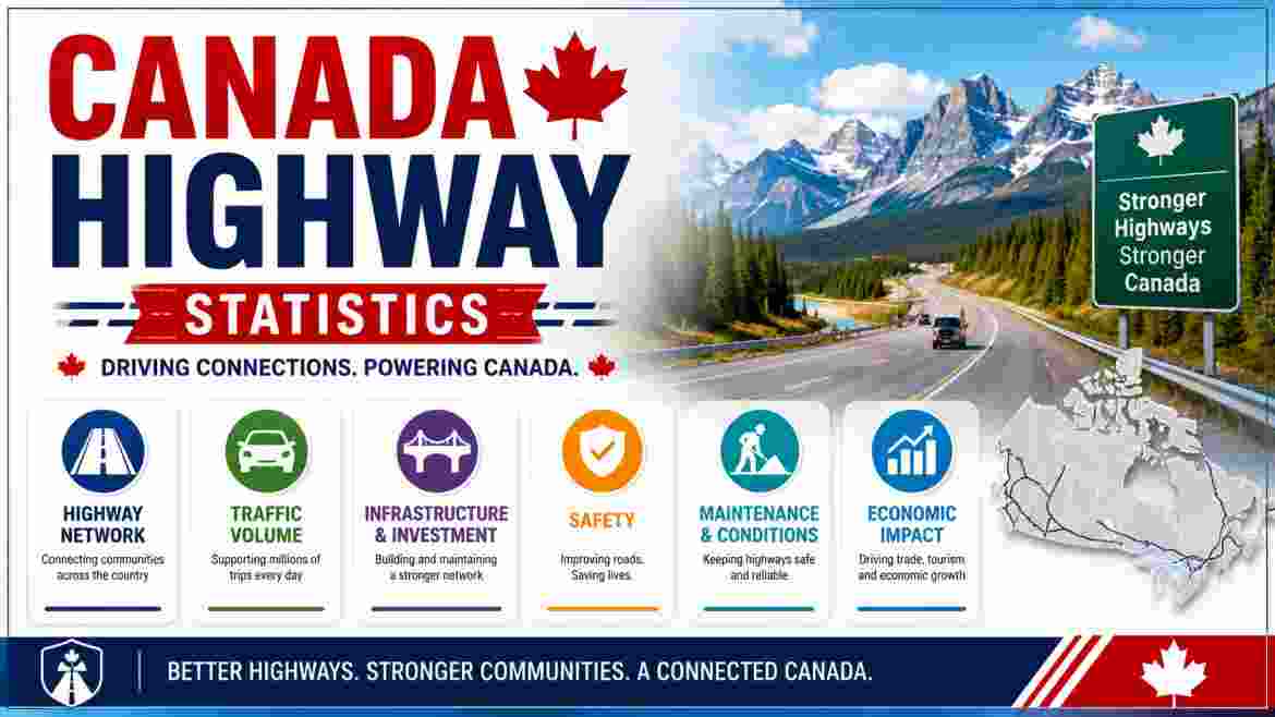
What Do Canada’s Highway Statistics Tell Us in 2026?
Canada’s road and highway network is one of the most extensive and consequential pieces of public infrastructure anywhere in the world — a system that physically connects the country’s cities, resources, communities, and borders across the second-largest land mass on Earth. In 2026, however, the story behind those kilometres is one of growing tension between a network that is indispensable to the country’s economy and daily life, and a maintenance and investment deficit that is stretching the system’s condition toward a threshold that engineers, municipal leaders, and federal analysts describe with increasing urgency. According to Statistics Canada’s 2020 National Road Survey — the most recent comprehensive count of Canada’s full public road inventory — there are over 1,042,718 kilometres of public road in Canada, including 52,722 kilometres of designated highways, 115,121 kilometres of rural highways, 115,575 kilometres of arterial roads, and 597,701 kilometres of local roads. Canada’s National Highway System (NHS), the federally designated strategic transport network of primary intercity and interprovincial routes, encompasses 38,098 kilometres of the most economically significant corridors in this broader road network — and it is this system that carries the overwhelming bulk of Canada’s intercity freight and passenger movement.
The condition data sitting beneath these network-size figures paints a picture that is considerably less reassuring than the impressive scale of the system itself. Statistics Canada’s Core Public Infrastructure Survey, valued as at December 31, 2022, found that Canada’s entire road transportation asset base — roads, bridges, tunnels, and active transportation infrastructure — has a current replacement value of C$1.63 trillion, of which C$250.2 billion (15%) is rated in poor or very poor condition. In Quebec alone — whose highway network was built heavily in the 1960s and 1970s — the province’s own Transport Ministry confirmed in its 2025–26 infrastructure investment plan that only 58% of the provincial road network is considered to be in good condition, and the public repair bill stands at more than C$22.5 billion. A partial bridge deck collapse in Châteauguay in March 2026 brought those numbers to life in the most visceral possible way — triggering a parliamentary debate, urgent calls from the Quebec Order of Engineers, and a CBC investigation that described the country’s infrastructure condition as a “wake-up call” that has not yet been answered with sufficient resources. Understanding Canada’s highway statistics in 2026 means understanding not just how many kilometres of road the country has, but how much of it is quietly failing.
Interesting Facts About Canada’s Highway Statistics in 2026
| # | Fact |
|---|---|
| 1 | Canada has over 1,042,718 kilometres of public road in total, as per the most recent national road inventory |
| 2 | Canada’s road network includes 52,722 kilometres of designated highways and 115,121 kilometres of rural highways |
| 3 | The National Highway System (NHS) — Canada’s federally designated strategic transport network — spans 38,098 kilometres |
| 4 | Canada’s NHS was first designated in 1988 with 24,500 km; expanded in 2004 by 14,000 km to its current form |
| 5 | The NHS carried over 141 billion vehicle-kilometres of travel in 2016, including about 20 billion vehicle-kilometres of truck travel — the most recent fully reported figure |
| 6 | Total travel on the NHS increased 18% between 2005 and 2016, and has continued to grow since |
| 7 | More than C$43 billion was invested in the NHS from 2006/07 through 2017/18 |
| 8 | The current replacement value of all Canadian road transportation infrastructure — roads, bridges, tunnels, and active transport — was estimated at C$1.63 trillion as at December 31, 2022 |
| 9 | C$250.2 billion (15%) of all Canadian road transportation infrastructure is rated in poor or very poor condition |
| 10 | Quebec’s highway network repair deficit exceeds C$22.5 billion — with only 58% of the provincial network rated in good condition |
| 11 | Municipalities maintain approximately 60% of Canada’s essential infrastructure — including roads and bridges — yet receive only 8 cents of every tax dollar collected in Canada |
| 12 | The Canadian municipal average of roads in good condition is approximately 60% |
| 13 | Local and regional governments own 64% of the replacement value of all Canadian road infrastructure |
| 14 | Provincial and territorial governments own 69% of all Canadian bridges and tunnels by replacement value |
| 15 | Alberta Budget 2026 allocated C$8.3 billion over three years for transportation — the largest ministry capital allocation in provincial history — yet highway conditions are projected to still slightly deteriorate |
Source: Statistics Canada 2020 National Road Survey; Statistics Canada Core Public Infrastructure Survey (December 31, 2022 valuation), published October 2024; National Highway System Wikipedia (citing Transport Canada data); CBC News (March 16, 2026); Quebec Transport Ministry 2025–26 Infrastructure Investment Plan; Federation of Canadian Municipalities, Infrastructure Focus Area (2026); Alberta Budget 2026 Transportation Sector Analysis (albertabudget.ca, February 26, 2026); NHS Annual Report 2017; Canada.constructconnect.com (January 2025)
The 15 facts above position Canada’s highway and road infrastructure in 2026 as a system operating under a structural funding mismatch that has been building for decades. The C$250.2 billion replacement cost of road infrastructure already in poor or very poor condition is not a projection of future deterioration — it is an assessment of the current state of assets that have already crossed the threshold of acceptable condition. When 15% of a C$1.63 trillion asset base has degraded to the point where replacement costs a quarter-trillion dollars, the maintenance deficit is no longer a future risk to be managed; it is a present reality to be funded. The March 2026 Châteauguay bridge partial deck collapse in Quebec crystallised this reality for the Canadian public in a way that statistical reports rarely can — a physical structure built in the 1960s, scheduled for demolition in 2025, then deferred, then failing publicly — perfectly illustrating the consequences of chronic infrastructure underfunding at a time when repair backlogs systematically push necessary interventions further into the future.
The tax revenue mismatch documented by the Federation of Canadian Municipalities is central to understanding why the deficit persists. Municipalities maintain 60% of Canada’s essential infrastructure — the roads, bridges, local highways, and arterial networks that Canadians use for daily commutes, goods movement, and emergency services access — yet receive only 8 cents of every tax dollar collected in Canada, with the vast majority of revenue flowing to the federal and provincial governments. This structural misalignment between infrastructure responsibility and revenue capacity creates an environment where municipal road budgets are chronically insufficient relative to actual maintenance need — as Calgary’s own pavement asset management report made explicit in finding that at its 2024 annual funding level of C$47.8 million, the city’s 17,000-kilometre road network valued at C$15 billion would deteriorate by 3.2% annually, or 26% by 2034.
Canada’s National Highway System in 2026 | Network by Province & Territory
National Highway System — Kilometres by Province/Territory (Current)
━━━━━━━━━━━━━━━━━━━━━━━━━━━━━━━━━━━━━━━━━━━━━━━━━━━━━━━━━━━━━━━━━━━━
British Columbia          ████████████████████████████████████████  7,040 km (largest)
Ontario                   ████████████████████████████████████████  6,795 km
Quebec                    ████████████████████████████████████████  5,647 km
Alberta                   ████████████████████████████████          4,545 km
Saskatchewan              ████████████████████████                  2,689 km
Yukon Territory           ████████████████████████                  2,017 km
Newfoundland & Labrador   ████████████████████████                  2,467 km
Manitoba                  █████████████████████                     2,095 km
Northwest Territories     ████████████████████                      1,423 km
New Brunswick             ████████████████████                      1,802 km
Nova Scotia               ███████████████████                       1,199 km
Prince Edward Island      █████                                     398 km (smallest)
NHS Total                 ████████████████████████████████████████  38,098 km
━━━━━━━━━━━━━━━━━━━━━━━━━━━━━━━━━━━━━━━━━━━━━━━━━━━━━━━━━━━━━━━━━━━━
Scale: Each █ ≈ approx. 200 km
| Province / Territory | NHS Kilometres | Key Route / Significance |
|---|---|---|
| British Columbia | 7,040 km (largest in Canada) | Trans-Canada (Hwy 1), Yellowhead (Hwy 16), Pacific and US border corridors |
| Ontario | 6,795 km | 400-series highways; highest traffic volume nationally; connects Toronto–Ottawa–Windsor–Sudbury |
| Quebec | 5,647 km | Autoroutes; Trans-Canada corridor; Montreal–Quebec City–US border; aging network crisis |
| Alberta | 4,545 km | CANAMEX corridor (Hwy 2); Yellowhead (Hwy 16); resource export arteries |
| Saskatchewan | 2,689 km | Trans-Canada (Hwy 1); agriculture and potash export corridors |
| Newfoundland & Labrador | 2,467 km | Trans-Canada across the island; critical isolated corridor |
| Manitoba | 2,095 km | Trans-Canada (Hwy 1); CANAMEX corridor; grain export routes |
| Yukon Territory | 2,017 km | Alaska Highway; Klondike Highway; critical remote corridor |
| New Brunswick | 1,802 km | Trans-Canada; Atlantic trade corridor; US border routes |
| Northwest Territories | 1,423 km | Northern / remote classification; includes Dempster Highway and ice road connections |
| Nova Scotia | 1,199 km | Trans-Canada; Halifax corridor; Atlantic Gateway connectivity |
| Prince Edward Island | 398 km (smallest) | Trans-Canada (Confederation Bridge connection); island-wide NHS coverage |
| Nunavut | 0 km | No NHS designation — Nunavut has no conventional road connections to any other province/territory |
| NHS Total | 38,098 km | Includes Core Routes, Feeder Routes, and Northern/Remote Routes |
Source: Transport Canada National Highway System data, compiled in Wikipedia “National Highway System (Canada)”; Transport Canada NHS Annual Report
The provincial breakdown of National Highway System kilometres reveals the direct relationship between geographic scale, economic significance, and NHS network size. British Columbia’s 7,040 km edges out Ontario’s 6,795 km for the largest provincial NHS share, reflecting BC’s combination of immense geographic scale, critical Pacific trade corridors connecting Vancouver and Prince Rupert ports to the continental interior, and the extensive mountain highway network that makes BC some of the most technically challenging highway infrastructure in the country to build and maintain. The Trans-Canada Highway — the iconic route that runs from Victoria, BC to St. John’s, Newfoundland — threads through all of these provincial systems and remains the single most recognizable piece of the NHS network, though it is far from the only strategically critical corridor. The CANAMEX trade corridor running north-south through Alberta, Saskatchewan, and Manitoba to the US border is a key artery for continental freight, particularly agricultural exports.
The complete absence of Nunavut from the NHS is a stark reminder of how unevenly Canada’s road infrastructure is distributed across its vast territory. The largest province or territory by area — at 2.09 million square kilometres, larger than Western Europe — Nunavut has no conventional road connections whatsoever to any other Canadian jurisdiction, making it entirely dependent on air transport and seasonal winter roads and marine shipping for goods movement. This is not a condition unique to Nunavut: the Northwest Territories’ 1,423 km NHS designation consists almost entirely of remote and seasonal routes, and the Yukon’s 2,017 km runs through some of the most isolated terrain on the continent. Northern connectivity remains one of the most persistent infrastructure gaps in Canada, and one that federal and territorial governments have identified as both a sovereignty and economic equity priority in the context of Northern development and climate change-driven permafrost degradation that is actively destroying existing road infrastructure in the Arctic.
Canada’s Road Condition Data in 2026 | Provincial & National Assessment
Canada Road Condition Profile — Key Provincial Snapshots (2025–2026 Data)
━━━━━━━━━━━━━━━━━━━━━━━━━━━━━━━━━━━━━━━━━━━━━━━━━━━━━━━━━━━━━━━━━━━━
Quebec network "Good" condition         ████████████████████████████████  58% (42% not in good condition)
Quebec repair deficit                   ████████████████████████████████  C$22.5 billion+
Alberta highway "Good" (current)        ████████████████████████████████████████ 59% (declining to 57%)
Alberta highway "Poor" (projected 2027) ████████████████                  16% (up from 14%)
Canadian municipal avg "Good"           ████████████████████████████████████████ ~60%
National poor/very poor (road infra.)   ████████████████████████████████████████ 15% (C$250.2B replacement cost)
Calgary road deterioration rate         ████████████████████████████████████████ 3.2% annually at current funding
━━━━━━━━━━━━━━━━━━━━━━━━━━━━━━━━━━━━━━━━━━━━━━━━━━━━━━━━━━━━━━━━━━━━
Scale: Each █ ≈ proportional condition share
| Jurisdiction / Condition Metric | Key Finding | Source |
|---|---|---|
| National — poor/very poor road infra. | 15% of total C$1.63 trillion asset base in poor/very poor condition = C$250.2 billion replacement cost | Statistics Canada Core Public Infrastructure Survey, 2022 data |
| Canadian municipal average “good” condition | ~60% | Calgary pavement management report, citing Canadian municipal average |
| Quebec provincial network — good condition | Only 58% rated good | Quebec Transport Ministry 2025–26 plan, cited by CBC News March 2026 |
| Quebec road repair deficit | More than C$22.5 billion | Quebec Transport Ministry public documents |
| Quebec 10-year maintenance plan | 85% of infrastructure funds earmarked for maintenance = C$30 billion over 10 years | Quebec Finance Minister statement, CBC News March 2026 |
| Alberta highway — good condition (2026 budget) | 59% good (declining to 57% in next period) | Alberta Budget 2026 Transportation Sector Analysis |
| Alberta highway — poor condition (projected) | 14% currently, rising to 16% despite C$1.97B CMR investment | Alberta Budget 2026 Transportation Sector Analysis |
| Alberta 3-year transportation capital budget | C$8.3 billion — largest in provincial history | Alberta Budget 2026, February 26, 2026 |
| Calgary road deterioration rate | 3.2% annually at current funding; 26% by 2034 if unchanged | Calgary pavement asset management report, January 2025 |
| National bridges on NHS (2017 figure) | 10,805 bridges on the National Highway System alone | NHS Annual Report 2017 |
| Municipally-owned bridge/road condition | Chronically underfunded — FCM warns of “increasingly poor repair” | FCM Infrastructure Focus Area, 2026 |
| Federal Investing in Canada Infrastructure Program | Ends 2026–27 — removal of key federal co-funding source for municipalities | Alberta Budget 2026 analysis; multiple municipal sources |
Source: Statistics Canada Core Public Infrastructure Survey (October 2024); CBC News (March 16, 2026); Quebec Transport Ministry 2025–26 Infrastructure Investment Plan; Alberta Budget 2026 Transportation Sector Analysis (albertabudget.ca, February 26, 2026); Calgary pavement asset management report (January 2025); Federation of Canadian Municipalities (2026); NHS Annual Report 2017
The road condition data across Canada in 2026 paints a consistent picture regardless of which province or metric you examine: a network where the maintenance investment needed to sustain current condition levels is systematically below what the asset base actually requires, producing a slow but measurable drift toward deterioration that no single budget cycle is reversing. The fact that Alberta’s Budget 2026 — with the largest transportation capital allocation in the province’s history at C$8.3 billion over three years, including C$1.97 billion specifically for roads and bridges maintenance — still projects highway conditions to deteriorate (good condition dropping from 59% to 57%, poor condition rising from 14% to 16%) is perhaps the most striking single data point in the 2026 condition dataset. When the largest transportation investment in a province’s history is insufficient to prevent further deterioration, the structural scale of the maintenance backlog becomes impossible to dismiss.
Quebec’s situation is the most publicly visible and politically charged highway condition story in Canada in 2026. The partial deck collapse of the Sauvagine Bridge in Châteauguay in March 2026 — a reinforced concrete beam bridge built in the 1960s, known to be at end of life, with a planned demolition that had been deferred — triggered a national conversation about the human consequences of infrastructure deferral that statistics alone rarely produce. The Quebec Order of Engineers’ public statement that “we were surprised that something like that would happen, but at the same time we’re not surprised because there’s a big deficit” captures exactly the relationship between data and physical reality: the C$22.5 billion repair deficit and 42% of the provincial network not in good condition are abstract figures until a bridge deck fails on a city road — and then they become concrete and immediate. Quebec’s commitment to allocate 85% of its infrastructure funds to maintenance over the next decade is a recognition that the province cannot build its way out of a condition problem; it must repair, and it must repair consistently.
Canada Highway Investment & Key Infrastructure Projects in 2026
Major Canadian Highway Capital Projects — 2025–2027 Active Pipeline
━━━━━━━━━━━━━━━━━━━━━━━━━━━━━━━━━━━━━━━━━━━━━━━━━━━━━━━━━━━━━━━━━━━━
BC Fraser River Crossing                ████████████████████████████████████████  C$4.15 billion
Quebec Louis-Hippolyte-La Fontaine      ████████████████████████████████████████  C$2.5 billion (2027)
Quebec Ville-Marie/Viger tunnels (Mtl.) ████████████████████████████████████████  C$2.0 billion (by 2030)
Quebec Highway 19 extension (Laval)     █████████████████████████████████████     C$899 million (2027)
Quebec Highway 3 twinning upgrades      ████████████████████████████████████      C$883 million
Alberta Hwy 3 twinning (Medicine Hat)   █████████████████████                     C$180 million (2026)
Alberta Bridge construction (3-yr)      ████████████████████████████████████████  C$420 million
Federal ICIP funding expiry             ████████████████████████████████████████  Ends 2026–27
━━━━━━━━━━━━━━━━━━━━━━━━━━━━━━━━━━━━━━━━━━━━━━━━━━━━━━━━━━━━━━━━━━━━
Scale: Each █ ≈ relative investment magnitude
| Project | Investment | Status in 2026 | Significance |
|---|---|---|---|
| BC Fraser River Crossing | C$4.15 billion | In motion; design-build procurement | Major new crossing on BC’s most critical highway corridor; largest active BC highway project |
| Quebec: Louis-Hippolyte-La Fontaine bridge-tunnel | C$2.5 billion | Active major structural work; completion 2027 | Major structural work, modernization, and service corridor redevelopment under St. Lawrence River |
| Quebec: Ville-Marie and Viger tunnels (Montreal) | C$2 billion+ | Active; winds down by 2030 | Major Montreal urban tunnel rehabilitation on Route 136 |
| Quebec: Highway 19 extension, Laval | C$899 million | Completion 2027 (Hwys 440–640 extension) | Key north-south Laval highway gap closure |
| Quebec: Highway 3 upgrades | C$883 million | Multiple phases | Strategic corridor upgrades |
| Alberta: Highway 3 twinning (Medicine Hat–Lethbridge corridor, 45 km) | C$180 million | In progress; could be complete by 2026 | Major safety and capacity upgrade on southern Alberta primary corridor |
| Alberta: Bridge construction (3-year provincial plan) | C$420 million | Active 2026–2028 | Provincial bridge renewal under Budget 2026 |
| Alberta: CMR highways (3-yr capital plan) | C$1.97 billion | Active 2026–2029 | Largest Roads & Bridges CMR allocation in Alberta history — yet still insufficient to reverse deterioration |
| Federal ICIP program expiry | N/A — funding source | Ends 2026–27 | Loss of major federal co-funding mechanism for municipal and provincial transportation projects |
Source: On-Site Magazine 2025 Infrastructure Report (June 2025); CBC News (March 2026); Alberta Budget 2026 Transportation Analysis (February 2026); Canada.constructconnect.com (March 2026)
The highway capital project pipeline for 2026 reflects a Canadian infrastructure sector that is simultaneously managing emergency rehabilitation on ageing structures, completing long-deferred major renewals, and attempting to add capacity on corridors where the original design standard can no longer accommodate current traffic volumes. The BC Fraser River Crossing at C$4.15 billion is the single largest active highway infrastructure project in Canada right now — a recognition that the existing crossings over the Fraser River, which serve as the primary land connection for Metro Vancouver’s southern municipalities and the primary truck route connecting the Port of Vancouver to trans-Canada corridors, are both physically inadequate for the traffic volumes they carry and structurally dated for the seismic risk zone in which they sit. It is precisely the kind of project whose deferral over decades ultimately forces a much larger investment when action can no longer be postponed.
The expiry of the Federal Investing in Canada Infrastructure Program (ICIP) in 2026–27 is one of the most consequential near-term events in the Canadian highway funding landscape, and its timing — precisely when municipal road condition data is at its worst and construction cost inflation remains elevated — is generating real concern among provincial and local governments. Canadian mayors warned publicly in March 2026 that slow federal infrastructure funding was already threatening the 2026 construction season, with municipalities facing the choice of delaying projects, scaling them back, or borrowing more to bridge the gap while federal approvals and disbursements lagged project timelines. The loss of ICIP as a co-funding mechanism after 2026–27, without a clear replacement programme at equivalent scale, risks creating exactly the funding vacuum that has historically allowed Canada’s infrastructure backlog to grow — the kind of gap between what is spent and what is needed that produces the C$250.2 billion poor-condition replacement bill that today’s budget papers are struggling to address.
Disclaimer: The data research report we present here is based on information found from various sources. We are not liable for any financial loss, errors, or damages of any kind that may result from the use of the information herein. We acknowledge that though we try to report accurately, we cannot verify the absolute facts of everything that has been represented.